The Winnipeg Free Press would like to show you notifications for breaking news and noteworthy local journalism.
No Thanks
Allow
Notification Settings
This browser doesn't support push notifications at the moment. Check browsers features, update your browser or try to use one from the list of recommended to manage your notifications settings:
Firefox (27+)
Google Chrome (30+)
Safari ( MacOS 13+ with browser 16.1+ and iOS 16.4+ ) / Note make sure Push API support enabled under Settings > Safari > Advanced > Experimental Features
Microsoft Edge
If you wish to manage your notification settings from this browser you will need to update your browser's settings for this site. Just click button below and allow notifications for this site
Note Safari 16.4+ working on iOS devices also need this site app to be installed at device's Home Screen for Push Notifications to work
Notifications are blocked for this site. If you wish to manage your notification settings from this browser you will need to update your browser's settings. Usually you'd need to click on site options icon to the left of address bar and change notifications preferences/permissions from there
We need your support! Local journalism needs your support!
As we navigate through unprecedented times, our journalists are working harder than ever to bring you the latest local updates to keep you safe and informed.
Now, more than ever, we need your support.
Starting at $15.99 plus taxes every four weeks you can access your Brandon Sun online and full access to all content as it appears on our website.
*Your next Free Press subscription payment will increase by $1.00 and you will be charged $20.95 plus GST for four weeks. After four weeks, your payment will increase to $24.95 plus GST every four weeks.
Hey there, time traveller!
This article was published 25/03/2011 (5553 days ago), so information in it may no longer be current.
Courtesy CKX fonds, S.J. McKee Archives, Brandon University
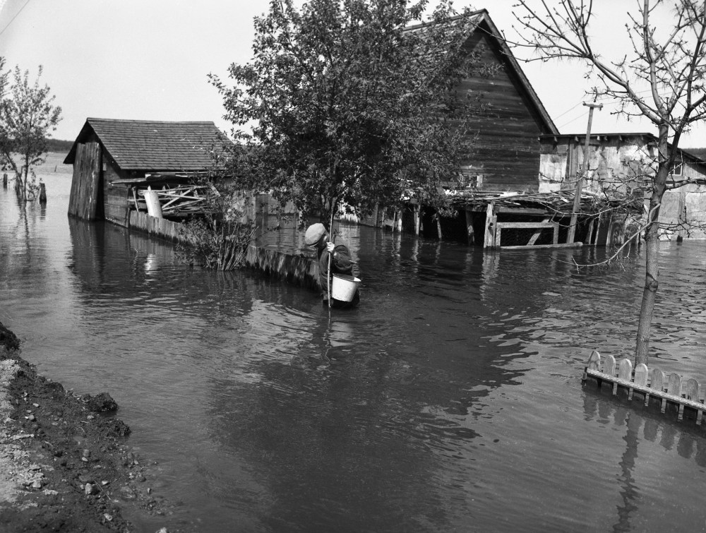
Floodwaters were precisely waist-high in this Brandon yard during the flood of 1954.Winnipeg Tribune Archives, 1954?
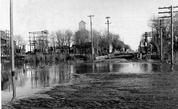
Flood waters from Bosshill and Gopher Creeks, tributaries of the Assiniboine River, this week flowed across the No. 22 highway at its entrance to Virden.Courtesy CKX fonds, S.J. McKee Archives, Brandon University
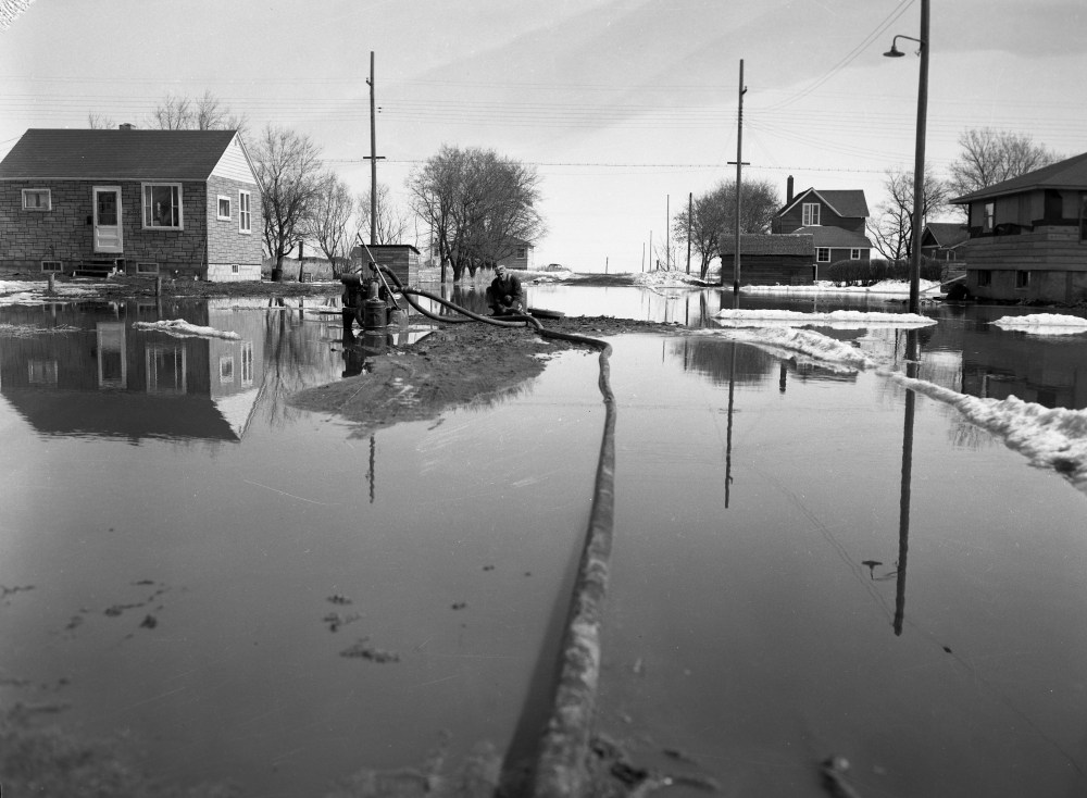
There was no provincial sump pump rebate program in place during the flood of 1954, but some pumps were used to keep floodwaters at bay.Courtesy CKX fonds, S.J. McKee Archives, Brandon University
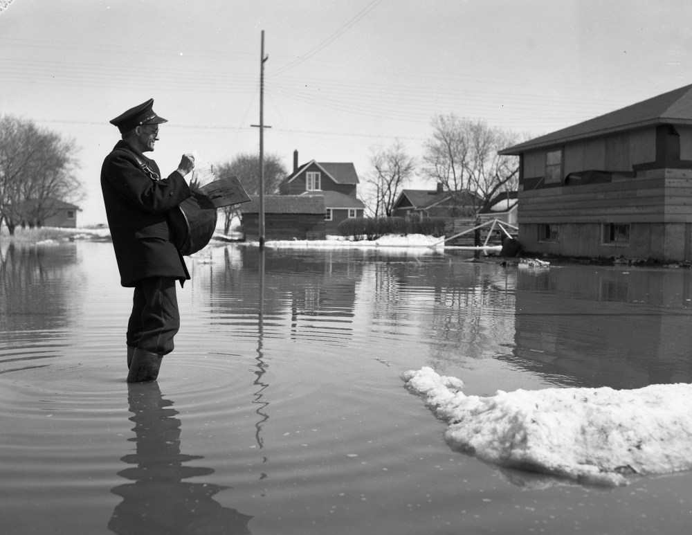
Neither snow, nor sleet, nor flood can stop the Brandon mail carriers in 1954.Courtesy CKX fonds, S.J. McKee Archives, Brandon University
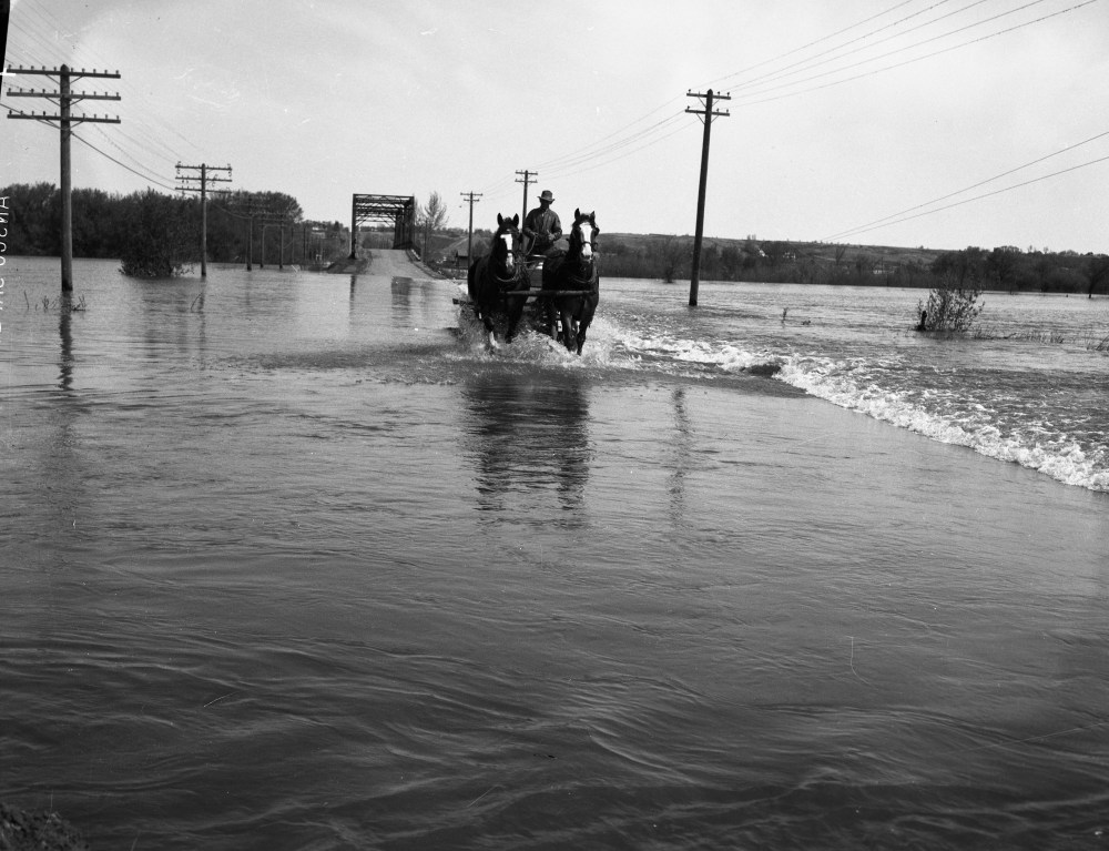
Horses can go where cars cannot, as this team crosses the flooded river just past the 18th Street bridge in 1954.Courtesy CKX fonds, S.J. McKee Archives, Brandon University
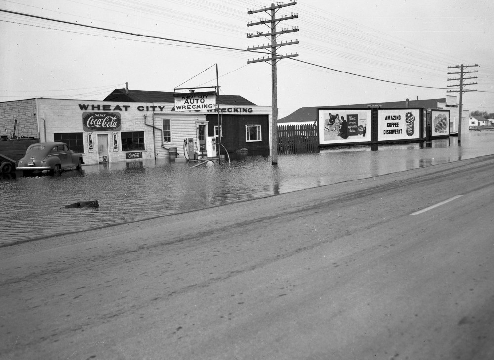
According to the 1954 Henderson Directory, the location of Wheat City Auto Wrecking was either 1080 or 1050 on 18th Street -- between Southern Avenue and Brandon Avenue. Was water really in the ditches that far away from the river? Or does this photo show a different location, closer to the river? Email website@brandonsun.com if you know more.Courtesy CKX fonds, S.J. McKee Archives, Brandon University
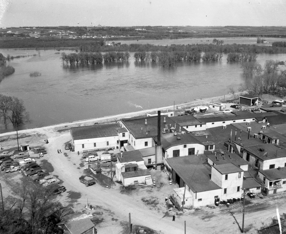
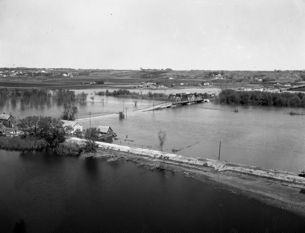
The buildings are safe, but the wide expanse of the Assiniboine River was visible in this photo from the flood of 1954. The picture appears to have been taken from near First Street and Pacific Avenue. Looking north, one can see the Brandon Mental Health Centre buildings near the horizon.Courtesy CKX fonds, S.J. McKee Archives, Brandon University
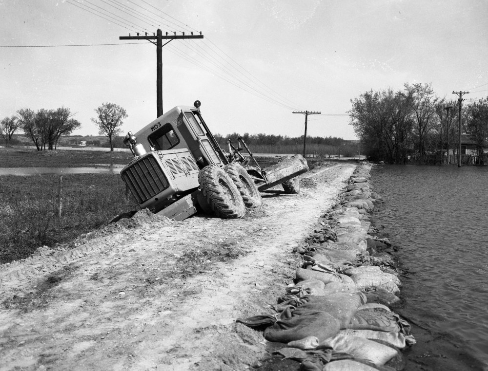
Water laps up against sandbags on the right-hand side of this image, from the flood of 1954.Courtesy CKX fonds, S.J. McKee Archives, Brandon University
The 18th Street bridge is dry, but all accesses are flooded out during this look at the 1954 Assiniboine River flood. Although the road in the foreground, which looks to be John Avenue, it doesn't appear to have served as an effective dike.Courtesy CKX fonds; S.J. McKee Archives; Brandon University
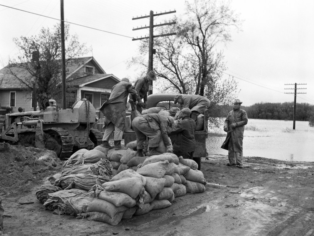
Workers load sandbags into a truck to fight the 1954 flood.Courtesy CKX fonds; S.J. McKee Archives; Brandon University
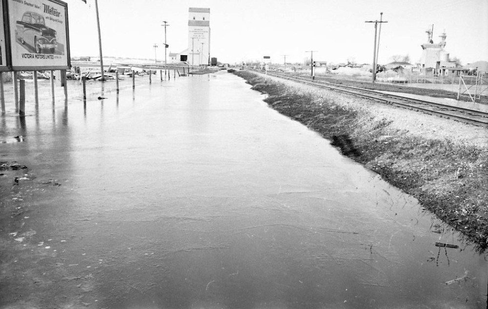
Do you recognize the location of this photo, taken during the flood of 1954? Some people think it shows the railway near Pacific Avenue, others point to the railway near Park Avenue.