The Winnipeg Free Press would like to show you notifications for breaking news and noteworthy local journalism.
No Thanks
Allow
Notification Settings
This browser doesn't support push notifications at the moment. Check browsers features, update your browser or try to use one from the list of recommended to manage your notifications settings:
Firefox (27+)
Google Chrome (30+)
Safari ( MacOS 13+ with browser 16.1+ and iOS 16.4+ ) / Note make sure Push API support enabled under Settings > Safari > Advanced > Experimental Features
Microsoft Edge
If you wish to manage your notification settings from this browser you will need to update your browser's settings for this site. Just click button below and allow notifications for this site
Note Safari 16.4+ working on iOS devices also need this site app to be installed at device's Home Screen for Push Notifications to work
Notifications are blocked for this site. If you wish to manage your notification settings from this browser you will need to update your browser's settings. Usually you'd need to click on site options icon to the left of address bar and change notifications preferences/permissions from there
We need your support! Local journalism needs your support!
As we navigate through unprecedented times, our journalists are working harder than ever to bring you the latest local updates to keep you safe and informed.
Now, more than ever, we need your support.
Starting at $15.99 plus taxes every four weeks you can access your Brandon Sun online and full access to all content as it appears on our website.
*Your next subscription payment will increase by $1.00 and you will be charged $20.00 plus GST for four weeks. After four weeks, your payment will increase to $24.00 plus GST every four weeks.
Hey there, time traveller!
This article was published 12/05/2011 (5440 days ago), so information in it may no longer be current.
Mike Deal / Winnipeg Free Press
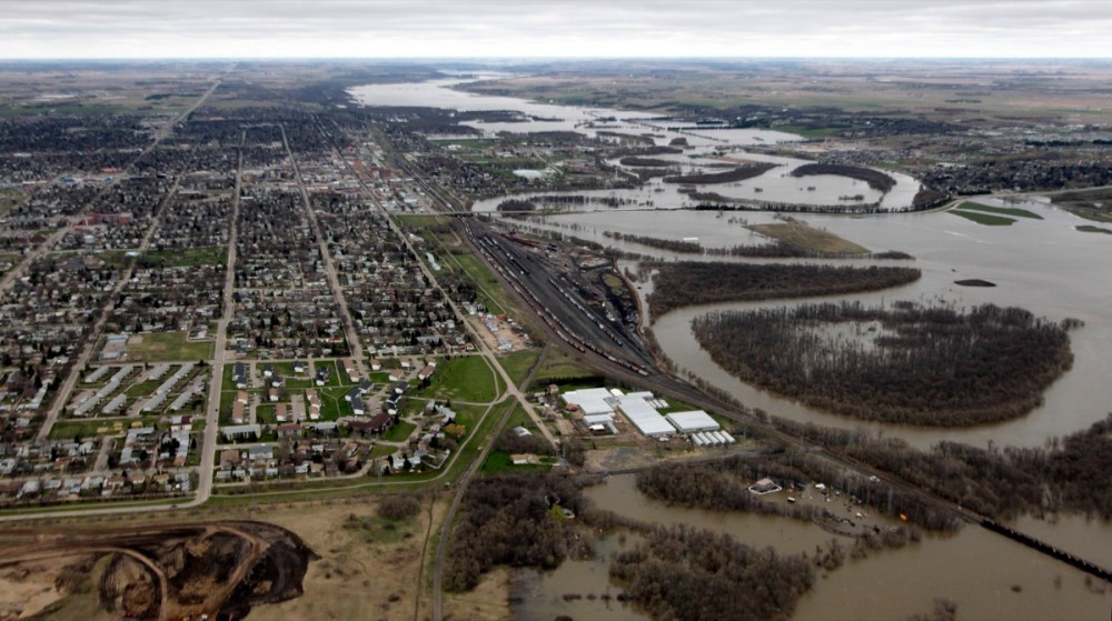
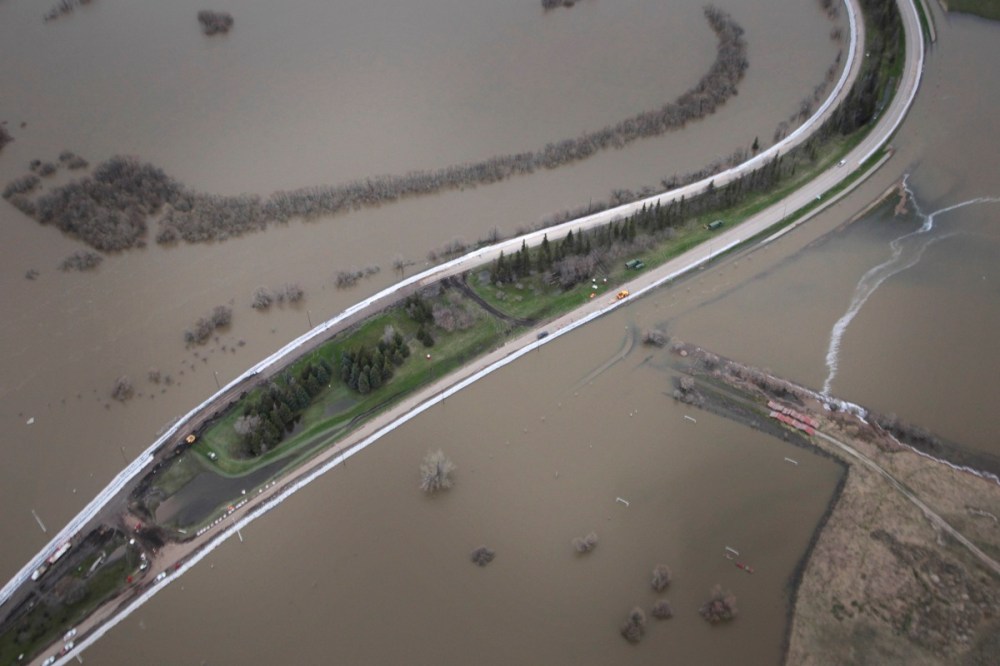
Looking west from over the Hydro plant in Brandon, the now-evacuated Green Spot is in the foreground, with the railway bridge in the RM of Cornwallis at the extreme bottom-right of the photo.Mike Deal / Winnipeg Free Press
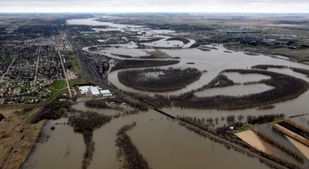
Looking west over Brandon, with the now-evacuated Green Spot greenhouses the prominent white buildings.Mike Deal / Winnipeg Free Press
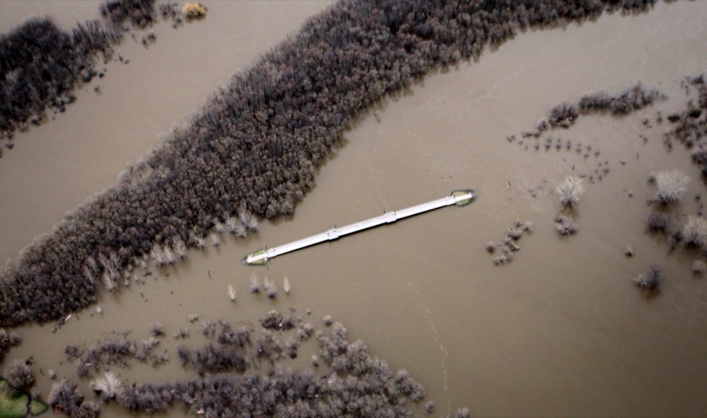
The pedestrian bridge remains dry in Brandon -- barely -- as the Assiniboine River rises around it.Mike Deal / Winnipeg Free Press
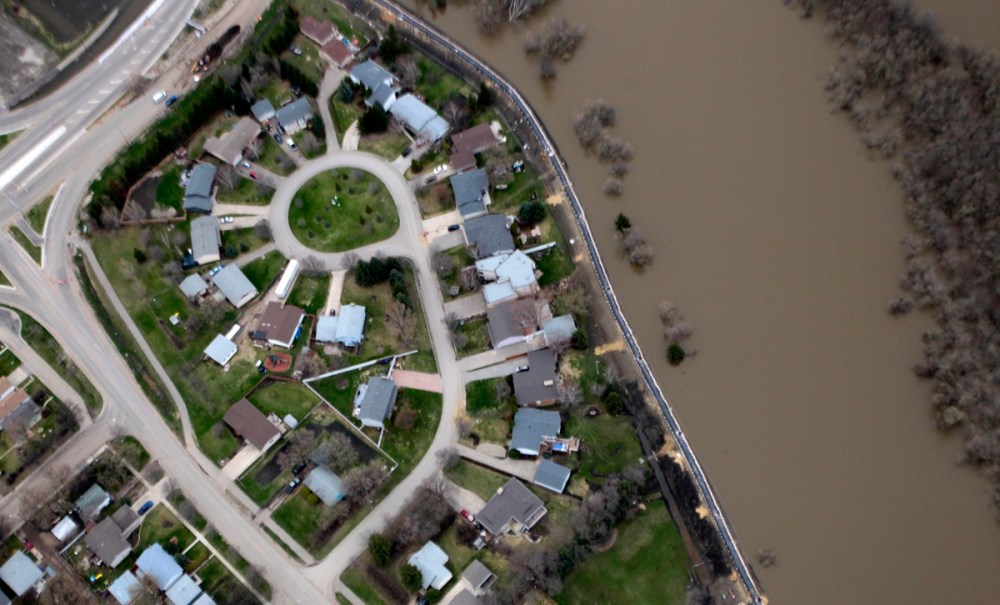
A brand-new earthen dike, hastily topped with sandbags and aqua dams, continues to keep out the Assiniboine waters from the residents of Kasiurak Bay.Mike Deal / Winnipeg Free Press
Work continues to shore up First Street North dikes and to repair the road itself. Officials say it's possible the road could open to limited traffic within the week.Mike Deal / Winnipeg Free Press
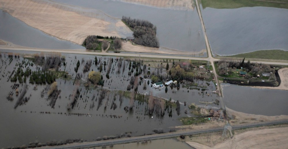
Homes threatened by the rising Assiniboine near Brandon.Mike Deal / Winnipeg Free Press
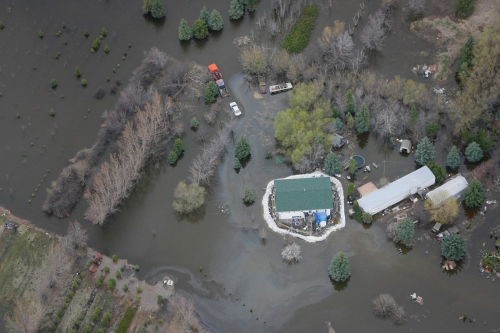
An oil slick soils the river's surface near this heavily sandbagged home.Mike Deal / Winnipeg Free Press
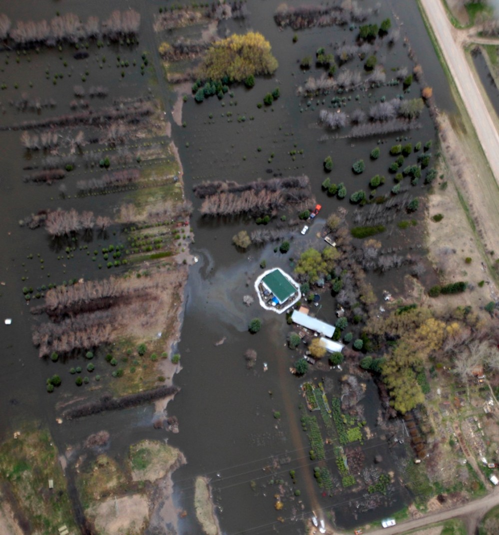
The vehicles are flooded, but the house stays dry, as waters rise around the sandbag wall.Mike Deal / Winnipeg Free Press
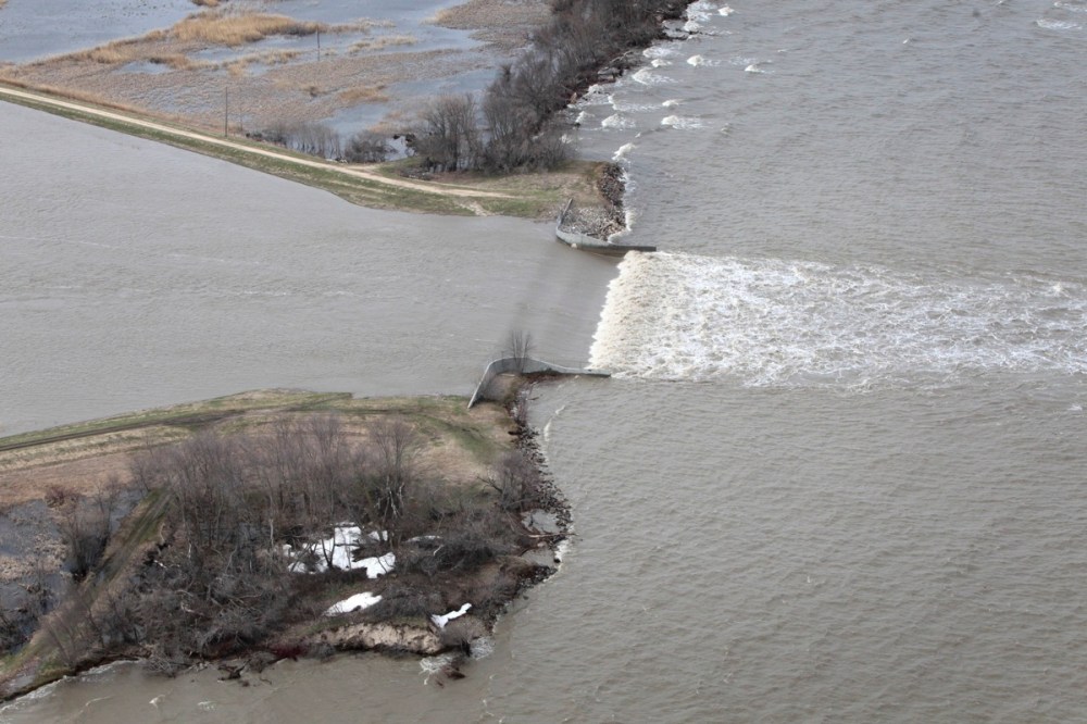
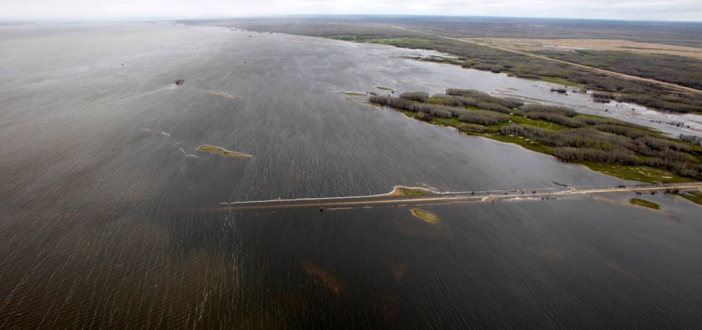
Water from the Portage Diversion spills into Lake Manitoba.Mike Deal / Winnipeg Free Press
Water from the Portage Diversion spills into Lake Manitoba.Mike Deal / Winnipeg Free Press
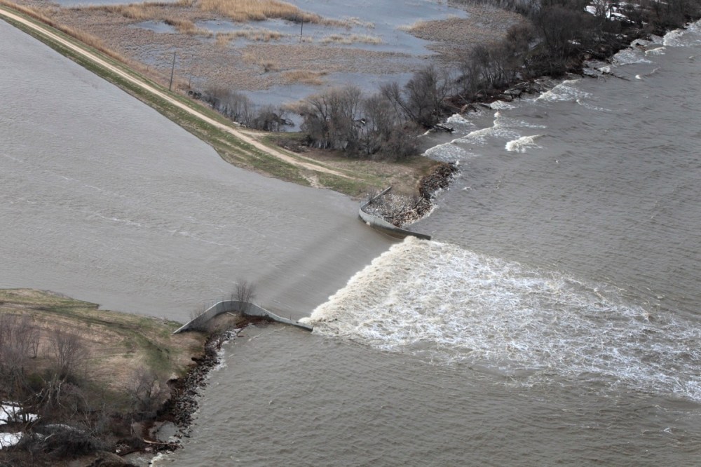
Water from the Portage Diversion overflows its banks spilling into fields west of the diversion close to Lake Manitoba.Mike Deal / Winnipeg Free Press
Water from the Portage Diversion overflows its banks spilling into fields west of the diversion close to Lake Manitoba.Mike Deal / Winnipeg Free Press
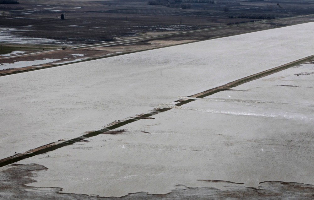
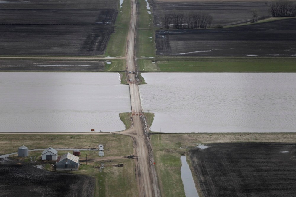
Water from the Portage Diversion just flows under the Highway 227 bridge.Mike Deal / Winnipeg Free Press
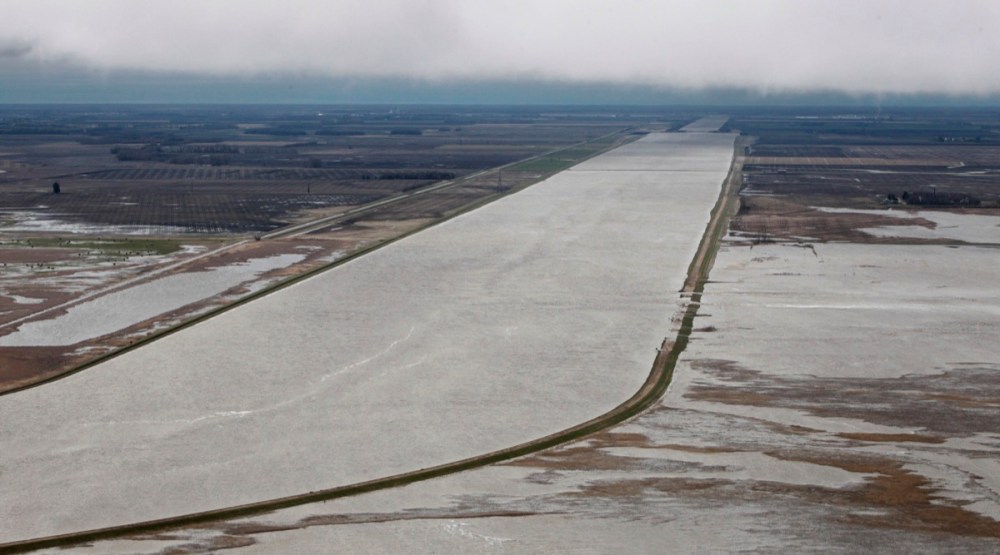
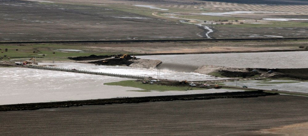
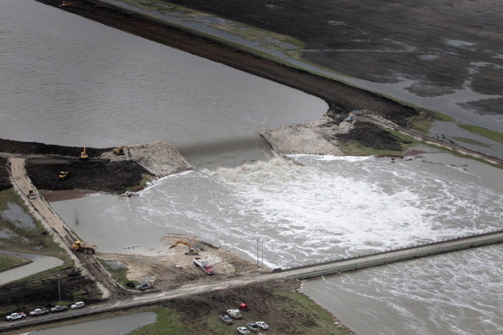
Construction at the staging gates of the Portage Diversion at rural road 71 N close to Lake Manitoba.Mike Deal / Winnipeg Free Press
Construction at the staging gates of the Portage Diversion at rural road 71 N close to Lake Manitoba.Mike Deal / Winnipeg Free Press
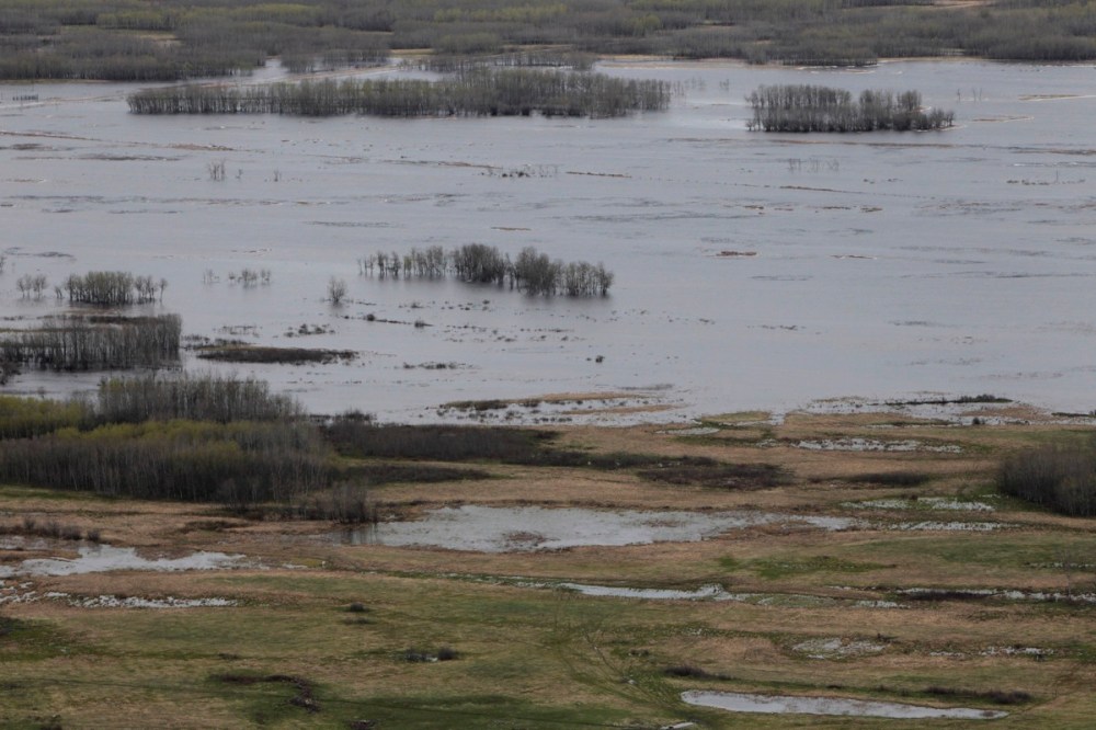
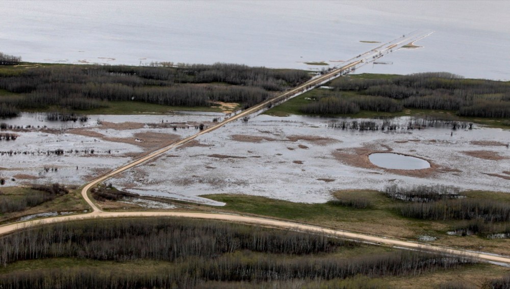
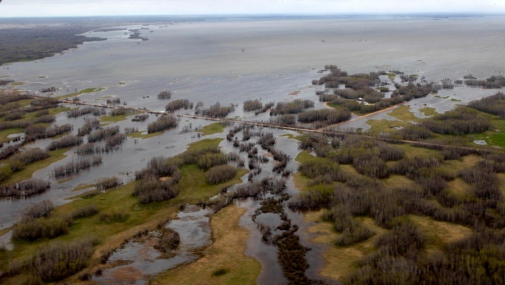
The three Shoal Lakes have essentially merged into one large lake just east of Lake Manitoba, overflowing their banks and flooding surrounding roads and farmlands.Mike Deal / Winnipeg Free Press
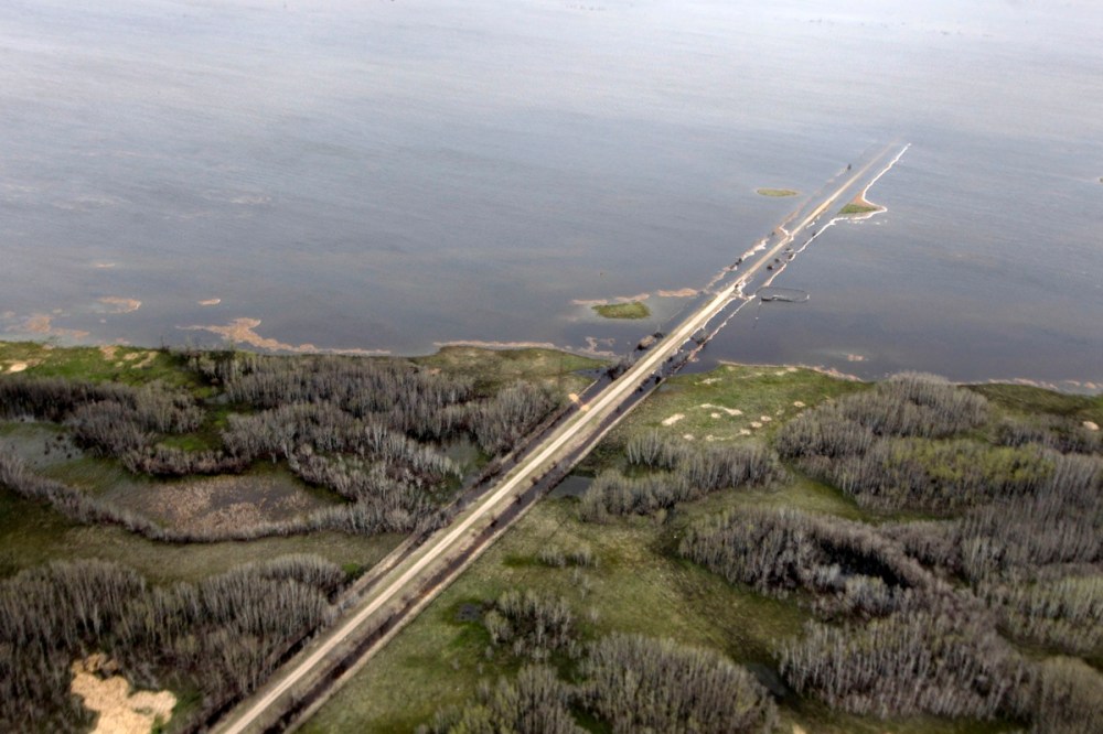
A road disappears into the merged Shoal Lakes, in the Interlake.Mike Deal / Winnipeg Free Press
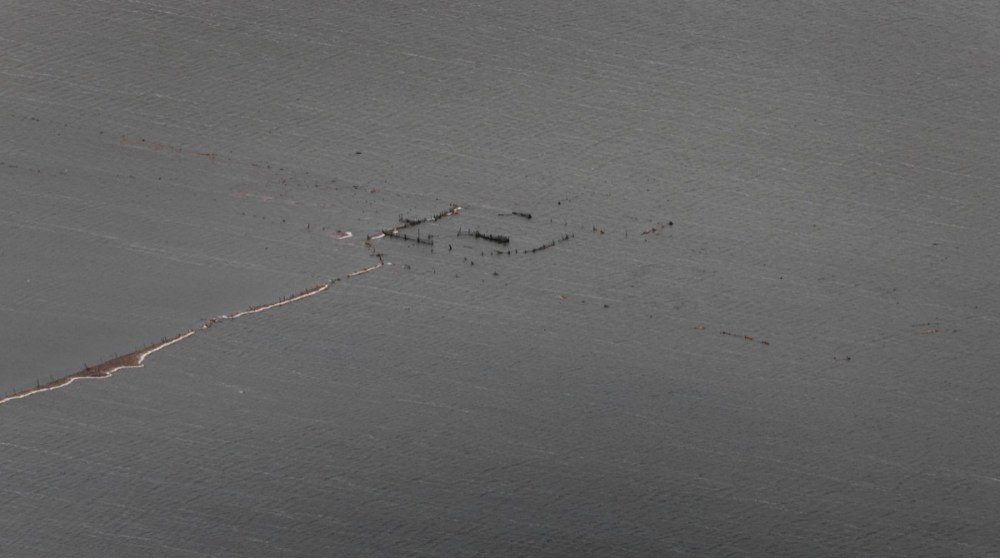
Little remains to mark what is normally dry land in the flooded Shoal Lakes.Mike Deal / Winnipeg Free Press
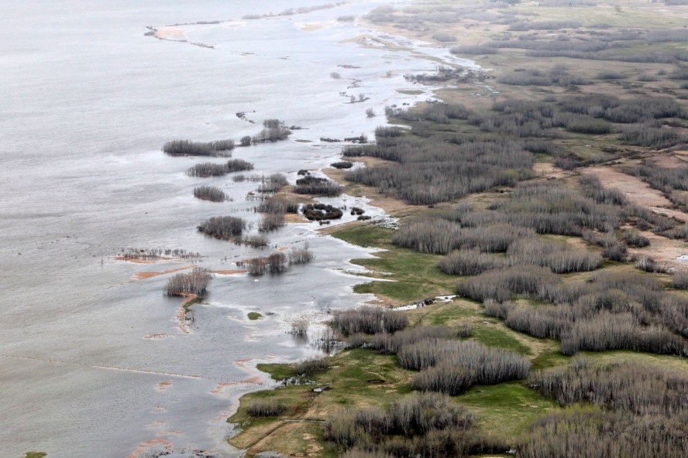
The banks of a three Shoal Lakes, merged into one, lap ever higher in the Interlake region.Mike Deal / Winnipeg Free Press
The three Shoal Lakes have essentially merged into one large lake just east of Lake Manitoba.The three Shoal Lakes have essentially merged into one large lake just east of Lake Manitoba overflowing its banks and flooding surrounding roads and farmlands.The three Shoal Lakes have essentially merged into one large lake just east of Lake Manitoba overflowing its banks and flooding surrounding roads and farmlands.