
Marine monitoring network in Quebec could help improve environmental regulations
Advertisement
Read this article for free:
or
Already have an account? Log in here »
We need your support!
Local journalism needs your support!
As we navigate through unprecedented times, our journalists are working harder than ever to bring you the latest local updates to keep you safe and informed.
Now, more than ever, we need your support.
Starting at $15.99 plus taxes every four weeks you can access your Brandon Sun online and full access to all content as it appears on our website.
Subscribe Nowor call circulation directly at (204) 727-0527.
Your pledge helps to ensure we provide the news that matters most to your community!
To continue reading, please subscribe:
Add Brandon Sun access to your Free Press subscription for only an additional
$1 for the first 4 weeks*
- Enjoy unlimited reading on brandonsun.com
- Read the Brandon Sun E-Edition, our digital replica newspaper
*Your next Free Press subscription payment will increase by $1.00 and you will be charged $20.95 plus GST for four weeks. After four weeks, your payment will increase to $24.95 plus GST every four weeks.
Read unlimited articles for free today:
or
Already have an account? Log in here »
MONTREAL – A new marine monitoring system that can detect undersea earthquakes, whale songs, ship noise and tidal activity could help improve environmental regulations, according to a recently-published study.
The monitoring network, developed by scientists from McGill University, Natural Resources Canada, the Université du Québec à Montréal and Dalhousie University, has been deployed in Quebec’s Bas-Saint-Laurent region along the south shore of the lower St. Lawrence River.
It combines underwater instruments with monitoring stations on the coast and land and allows for the simultaneous monitoring of earthquakes, water behaviour, human activity, and whales. This system provides “a comprehensive picture of what’s happening in, under, and at far distances from the water” — all with a single device.
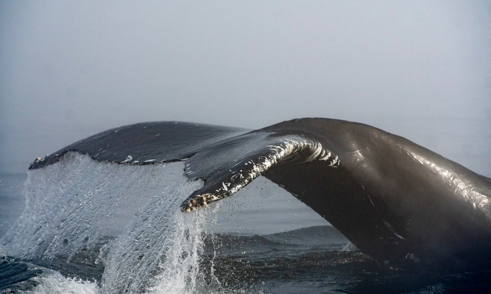
“I think this is a truly interesting, innovative, and original aspect of this project: for the first time, we were able to install this equipment on the riverbed and leave it in place for an extended period to record all these signals,” said the study’s lead author, Yajing Liu of McGill’s Department of Earth and Planetary Sciences.
The sea floor seismometers provided by the National Seismological Research Center and the stations made it possible to monitor activity throughout the estuary.
The team installed this network in the St. Lawrence River estuary between Rimouski and Sept-Îles. It was in place from September through May, between 2023 and 2025.
The researchers estimated that the experimental network detected “twice as many earthquakes as the National Earthquake Monitoring System, while also capturing whale calls, ship noise, tidal activity and mining blasts.”
“We use seismometers to record any source that might disturb or disrupt the sea floor and cause very slight vibrations at the sea floor,” said Liu. “These vibrations can therefore come from an earthquake, but they can also come from the calls of whales, since these emit acoustic waves through the water column and thus disturb the sea floor.”
Liu noted that the Lower St. Lawrence is not only one of the most seismically active areas in Canada, but also a heavily trafficked shipping corridor — activity that can harm whale habitats, since “the noise generated by maritime traffic can disrupt these animals’ songs.”
“This is one of the main concerns regarding the estuary and the Gulf of St. Lawrence: the disruption of communication among whales caused by ship noise,” she said.
“This noise and the signals emitted by whales partially overlap at certain frequencies. And when ship noise becomes too loud, it interferes with communication among the whales.”
Liu and her colleagues are compiling a catalogue of whale songs, as well as a catalogue of noise generated by river transport, with the goal of “determining the extent to which these two elements overlap in space and time,” the researcher said.
While they were in place, the sensors continuously recorded 250 data points per second. The scientists then separated the different types of signals based on their frequency using spectral analysis.
They were then buried under a veritable tsunami of data.
The team initially noted that data from a single day showed whale songs and maritime traffic occurring at the same time and in the same location. This raises the question of the extent to which ship noise interferes with communication among these large mammals.
The instruments also picked up signals related to tidal activity, the study revealed.
Ocean current models developed by oceanographers are frequently based on measurements taken at the water’s surface or at depths of a few dozen meters within the water column, but they often lack measurements taken directly at the ocean floor or riverbed, Liu noted.
“Since the seismometers provide constraints at the lower layer of these ocean current models, this allows us to better predict ocean circulation in the estuary,” she said. “This has broader implications for the ecosystem, since we know that whales depend on circulation for their nutrient supply.”
Liu’s team had previously deployed land-based seismometers along the coast of the St. Lawrence estuary. These devices had detected an increase in the number of whale songs during the winter months.
“We stumbled upon certain regular signals that we later identified as the repetitive calls of fin whales and blue whales, picked up by these land-based stations,” said Liu. “We compiled a catalogue of whale calls, but in order to be detected, the calls had to come from very close to the stations. We were certainly missing a large portion of the calls when the whales were swimming in the middle of the river.”
The effectiveness of land-based seismographs decreases as they get farther from the coast. Since the St. Lawrence estuary can be as wide as 100 kilometres in some places, what was happening farther offshore essentially escaped detection.
Seabed seismometers get around this problem by being deployed, as their name suggests, directly on the riverbed.
They may help shed light on a phenomenon that has puzzled researchers: data collected by land-based seismometers suggest that, rather than heading straight for Florida, whales spend more time in the estuary during the winter months, though it’s not entirely clear why.
“This may be related to the warming of the water over time, but we’ll need to confirm this with marine biologists,” said Liu.
The researchers believe that the data obtained through this “unique and multi-faceted system … could guide environmental protection efforts and the regulation of maritime traffic on one of Canada’s busiest waterways.”
The findings of this study were published in the scientific journal Seismica.
This report by The Canadian Press was first published July 19, 2026.