Shellmouth keeping Assiniboine in check: Province
Advertisement
Read this article for free:
or
Already have an account? Log in here »
We need your support!
Local journalism needs your support!
As we navigate through unprecedented times, our journalists are working harder than ever to bring you the latest local updates to keep you safe and informed.
Now, more than ever, we need your support.
Starting at $15.99 plus taxes every four weeks you can access your Brandon Sun online and full access to all content as it appears on our website.
Subscribe Nowor call circulation directly at (204) 727-0527.
Your pledge helps to ensure we provide the news that matters most to your community!
To continue reading, please subscribe:
Add Brandon Sun access to your Free Press subscription for only an additional
$1 for the first 4 weeks*
*Your next subscription payment will increase by $1.00 and you will be charged $20.00 plus GST for four weeks. After four weeks, your payment will increase to $24.00 plus GST every four weeks.
Read unlimited articles for free today:
or
Already have an account? Log in here »
Hey there, time traveller!
This article was published 26/04/2011 (5487 days ago), so information in it may no longer be current.
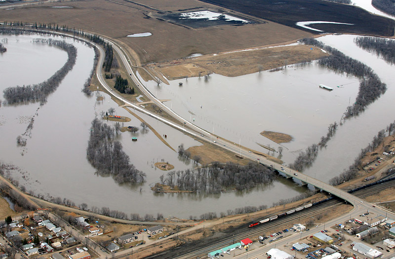
Provincial flood officials say the Shellmouth Reservoir has kept the Assiniboine River down by more than a metre in Brandon.
According to the latest provincial flood bulletin, released today at 3 p.m., it’s estimated that the Assiniboine River would be four feet (1.22 metres) higher in Brandon without the protection afforded by the Shellmouth dam.
With the Assiniboine River currently at 358.53 metres above sea level (measured at the First Street Bridge), that additional water would push the river up to 359.75 metres. That would be nearly 25 cm higher than the flood of 1976, and higher than the highest-ever recorded level, in 1923.
Inflows to the Shellmouth Reservoir are about 14,000 cubis feet per second, and the dam is currently releasing as much water as it can, about 5,300 cfs. Flood forecasters say that the reservoir is expected to handle a record volume this spring: about 750,000 acre feet of water, or the equivalent of 370,000 Olympic-sized swimming pools. That’s twice the actual volume of the reservoir itself.
Water levels in Brandon are expected to continue to rise until the river peaks, sometime between April 29 and May 3, and the river is expected to remain high for about 10 days.
Flood warnings have been issued for the Souris River from Melita and all downstream reaches; the Qu’Appelle River in the St-Lazare area; the Assiniboine River downstream of Shellmouth Bridge to Portage la Prairie; Pipestone Creek, all reaches; Oak Lake and Plum Lakes; and Plum Creek to the Souris River including the town of Souris.
Tributary flows from Pipestone Creek into Oak Lake had declined this morning. Despite the decrease in flows, high flows and higher water elevations will continue along the Plum Creek due to the significant volume of water in the Oak-Plum lake system.
Water levels on the Souris River at the town of Souris crested yesterday and decreased by 0.43 ft.
Water levels on the Souris River near Wawanesa are 1,157.93 ft., about the same as yesterday. The Souris River is forecast to crest in Wawanesa within the next few days and remain high for three to four days.
The flood warning for the Souris River from the U.S.-Canadian border and all reaches downstream has been moved downstream to include Melita and all downstream reaches.