Tropical Storm Humberto forms in the Atlantic as Hurricane Gabrielle takes aim at the Azores
Advertisement
Read this article for free:
or
Already have an account? Log in here »
We need your support!
Local journalism needs your support!
As we navigate through unprecedented times, our journalists are working harder than ever to bring you the latest local updates to keep you safe and informed.
Now, more than ever, we need your support.
Starting at $15.99 plus taxes every four weeks you can access your Brandon Sun online and full access to all content as it appears on our website.
Subscribe Nowor call circulation directly at (204) 727-0527.
Your pledge helps to ensure we provide the news that matters most to your community!
To continue reading, please subscribe:
Add Brandon Sun access to your Winnipeg Free Press subscription for only
$1 for the first 4 weeks*
*$1 will be added to your next bill. After your 4 weeks access is complete your rate will increase by $4.99 a X percent off the regular rate.
Read unlimited articles for free today:
or
Already have an account? Log in here »
MIAMI (AP) — Tropical Storm Humberto formed in the Atlantic Ocean on Wednesday at the same time Hurricane Gabrielle was racing across the ocean toward the Azores islands, forecasters said.
A hurricane warning was in effect for the volcanic archipelago which could experience dangerous conditions from Gabrielle as early as Thursday, the Miami-based National Hurricane Center said.
The storm is forecast to weaken but could cause significant coastal flooding in the island chain as well as large, destructive waves, forecasters said. From Thursday into Friday, Gabrielle may bring up to 5 inches (13 centimeters) of rain across the central and western Azores.
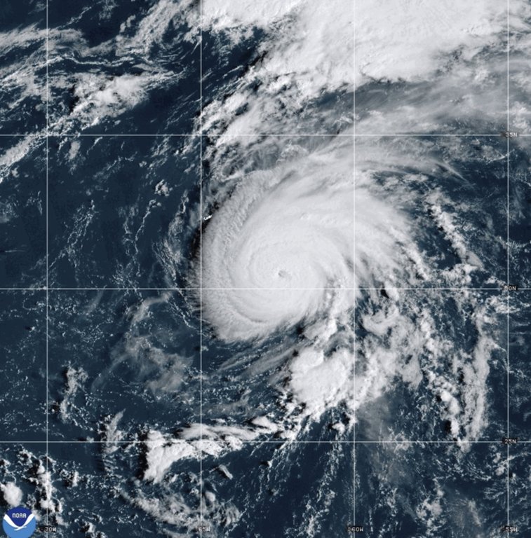
In the Northern Atlantic, Gabrielle was about 855 miles (1,375 kilometers) west of the Azores late Wednesday. It had maximum sustained winds of 85 mph (140 kph) and was traveling to the east at 31 mph (50 kph).
Waves generated by Gabrielle will continue to affect Bermuda, the U.S. East Coast from North Carolina northward and the Atlantic coast of Canada, forecasters said. Life-threatening surf and rip currents are possible.
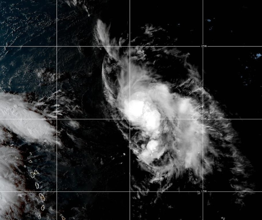
Tropical Storm Humberto was located 505 miles (815 kilometers) east-northeast of the northern Leeward Islands with maximum sustained winds of 45 mph (75 kph), the weather center said. Humberto is expected to affect the eastern coast of the U.S. with 39 mph winds within the next five days
In the Pacific, Hurricane Narda was moving away from Mexico, forecasters said. It had top sustained winds of about 90 mph (150 kph) late Wednesday.
Narda was about 580 miles (935 kilometers) south-southwest of the southern tip of Mexico’s Baja California peninsula, and was moving west at 10 mph (17 kph). No coastal watches or warnings were in effect as the hurricane was expected to continue moving further offshore.
Swells generated by Narda could bring rough surf and rip current conditions to some parts of coastal Mexico, forecasters said. The hurricane was expected to weaken over the next day or so, but restrengthen on Thursday and Friday.