Tropical Storm Arthur, the first of the Atlantic season, targets Gulf Coast with heavy rain
Advertisement
Read this article for free:
or
Already have an account? Log in here »
We need your support!
Local journalism needs your support!
As we navigate through unprecedented times, our journalists are working harder than ever to bring you the latest local updates to keep you safe and informed.
Now, more than ever, we need your support.
Starting at $15.99 plus taxes every four weeks you can access your Brandon Sun online and full access to all content as it appears on our website.
Subscribe Nowor call circulation directly at (204) 727-0527.
Your pledge helps to ensure we provide the news that matters most to your community!
To continue reading, please subscribe:
Add Brandon Sun access to your Free Press subscription for only an additional
$1 for the first 4 weeks*
- Enjoy unlimited reading on brandonsun.com
- Read the Brandon Sun E-Edition, our digital replica newspaper
*Your next Free Press subscription payment will increase by $1.00 and you will be charged $20.95 plus GST for four weeks. After four weeks, your payment will increase to $24.95 plus GST every four weeks.
Read unlimited articles for free today:
or
Already have an account? Log in here »
MIAMI (AP) — The first tropical storm of the Atlantic hurricane season formed Wednesday near the Gulf Coast, bringing intense rain and the threat of dangerous flash floods to states including Texas and Louisiana, meteorologists said.
Tropical Storm Arthur was a disorganized cluster of storms that brought rain for days over parts of eastern Mexico and the Gulf. The National Hurricane Center in Miami said conditions were conducive for a short-lived tropical storm to form.
National Hurricane Center director Michael Brennan said during a briefing that flash flood warnings were already being issued in the Houston metro area, with more likely to follow across the region, even after the center of the storm passes.
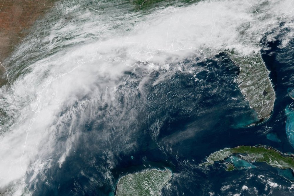
“The main threat from Arthur is going to be a prolonged, multiday, heavy rainfall event that could produce dangerous to life threatening flash flooding,” Brennan said.
Houston is hosting a World Cup match on Wednesday between Portugal and the Democratic Republic of the Congo. The stadium is covered, and no plans have been announced to move or reschedule the match.
The center of Tropical Storm Arthur was located Wednesday morning about 40 miles (65 kilometers) east-northeast of Port O’Connor, Texas, according to an advisory. The storm was moving northeast near 9 mph (15 kph), and an increase in forward speed was expected.
Arthur had maximum sustained winds of 40 mph. Little change in strength is expected before the center moves over land, forecasters said. Weakening is anticipated once it moves inland, and it could dissipate by Wednesday night or early Thursday.
Life-threatening flash flooding and urban flooding were the main threats as Arthur skirted the Gulf Coast. The hurricane center said in its key messages that flooding was likely through Friday over parts of Louisiana, Mississippi, Alabama, Georgia and the Florida Panhandle.
Arthur is expected to produce rainfall totals of 5-10 inches (13-25 centimeters), with isolated higher totals near 20 inches (50 centimeters). The combination of storm surge and the tide will cause normally dry areas near the coast to be flooded by rising waters moving inland from the shoreline.
Swells generated by Arthur are likely to cause life-threatening surf and rip current conditions along the northwestern Gulf Coast for the next couple of days. Tornadoes are possible through Thursday.