Brandon hit with winter weather wallop
Advertisement
Read this article for free:
or
Already have an account? Log in here »
We need your support!
Local journalism needs your support!
As we navigate through unprecedented times, our journalists are working harder than ever to bring you the latest local updates to keep you safe and informed.
Now, more than ever, we need your support.
Starting at $15.99 plus taxes every four weeks you can access your Brandon Sun online and full access to all content as it appears on our website.
Subscribe Nowor call circulation directly at (204) 727-0527.
Your pledge helps to ensure we provide the news that matters most to your community!
To continue reading, please subscribe:
Add Brandon Sun access to your Free Press subscription for only an additional
$1 for the first 4 weeks*
- Enjoy unlimited reading on brandonsun.com
- Read the Brandon Sun E-Edition, our digital replica newspaper
*Your next Free Press subscription payment will increase by $1.00 and you will be charged $20.95 plus GST for four weeks. After four weeks, your payment will increase to $24.95 plus GST every four weeks.
Read unlimited articles for free today:
or
Already have an account? Log in here »
Hey there, time traveller!
This article was published 12/10/2019 (2430 days ago), so information in it may no longer be current.
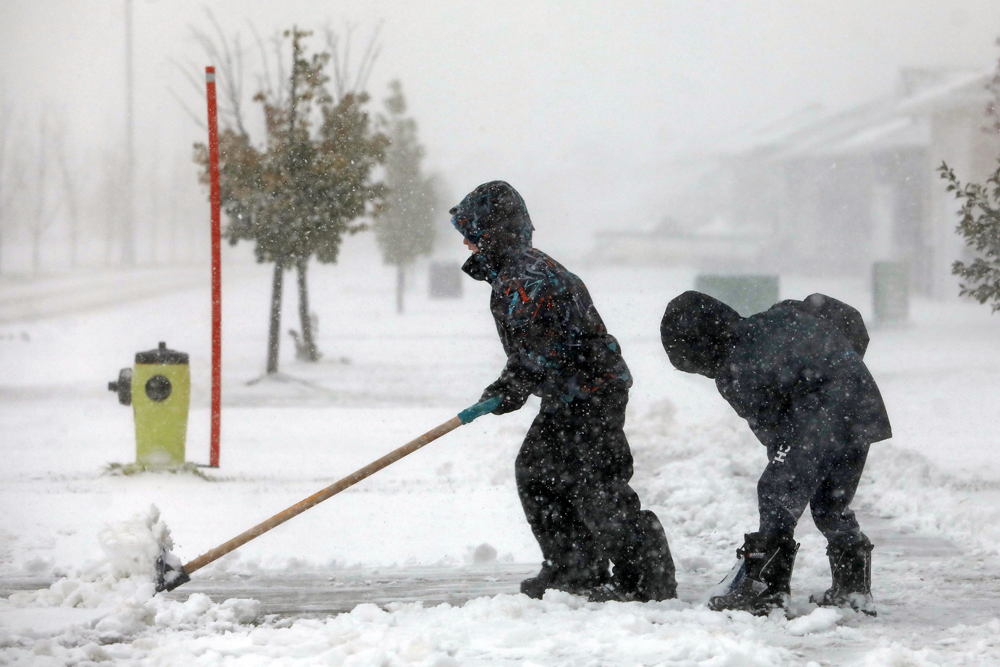
Winter is coming — or possibly already here.
Brandon was under a winter storm warning from Environment Canada all day Friday. Snow and blowing snow were expected throughout the day with up to 25 centimetres accumulating. Blowing snow was also expected overnight with an additional 15 to 25 cm.
Environment and Climate Change Canada warning preparedness meteorologist Terri Lang said a weather system called a Colorado low is to blame. She said to expect snow, ice pellets, rain and possibly thunder into Saturday as the storm moves from east to west across the province.
The weather systems are more common in the spring and fall when there is more moisture to the south, in the United States.
“This is a particularly potent one, it’s a particularly powerful one, so that notches it up on the rarity scale a little bit,” Lang said. “We don’t often see them this strong.”
A spokesperson for the City of Brandon said city plows and salt trucks were at the ready on Friday in case they were needed. One salt truck had been dispatched to handle the “hotspots” — hills and major intersections. The city was set to make a decision on weekend plowing Friday evening.
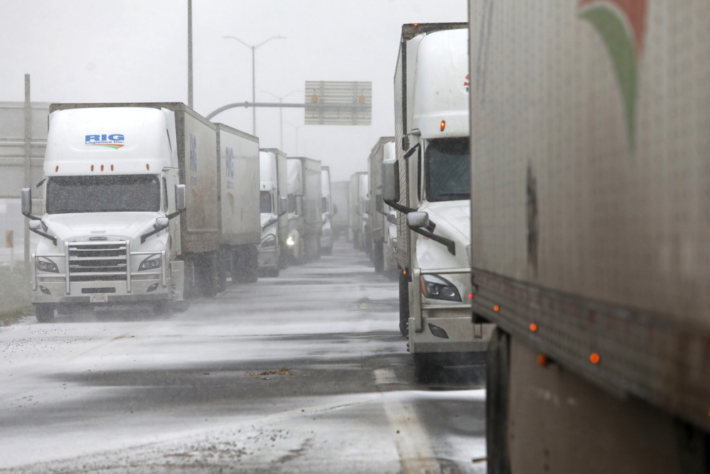
The storm has also affected highway travel. Late Friday afternoon, the entire Trans-Canada Highway between Brandon and Winnipeg remained closed, after first being closed in the morning. Most provincial highways on the west side of Winnipeg into the city also remained closed.
“Absolutely cancel travel plans if at all possible,” Lang said. “I would cancel travel plans this weekend just because I just think it’s not worth it.”
Older people should also avoid shovelling and snow clearing. The snow is very heavy and wet, which Lang described as “heart attack snow.”
The storm making its way through Manitoba into the weekend left more than 100,000 people without power, according to Manitoba Hydro. Lang said part of the issue is many trees still have leaves on them, which means more snow can accumulate and snap branches.
People should be prepared for lengthy power outages if they get hit. That means having extra food and water on hand, as well as charging electronic devices and even having spare battery packs ready.
“It’s a big storm, it’s affecting a lot of people, and I think because of the power outages … it’s kind of paralyzing everyone’s Thanksgiving plans,” she said.
“It’s time to get the old brain thinking about winter travel and what that means and being safe and being smart.”
» dmay@brandonsun.com
» Twitter: @DrewMay_