Waters continue to recede
Advertisement
Read this article for free:
or
Already have an account? Log in here »
We need your support!
Local journalism needs your support!
As we navigate through unprecedented times, our journalists are working harder than ever to bring you the latest local updates to keep you safe and informed.
Now, more than ever, we need your support.
Starting at $15.99 plus taxes every four weeks you can access your Brandon Sun online and full access to all content as it appears on our website.
Subscribe Nowor call circulation directly at (204) 727-0527.
Your pledge helps to ensure we provide the news that matters most to your community!
To continue reading, please subscribe:
Add Brandon Sun access to your Free Press subscription for only an additional
$1 for the first 4 weeks*
*Your next subscription payment will increase by $1.00 and you will be charged $20.00 plus GST for four weeks. After four weeks, your payment will increase to $24.00 plus GST every four weeks.
Read unlimited articles for free today:
or
Already have an account? Log in here »
Hey there, time traveller!
This article was published 09/07/2020 (2052 days ago), so information in it may no longer be current.
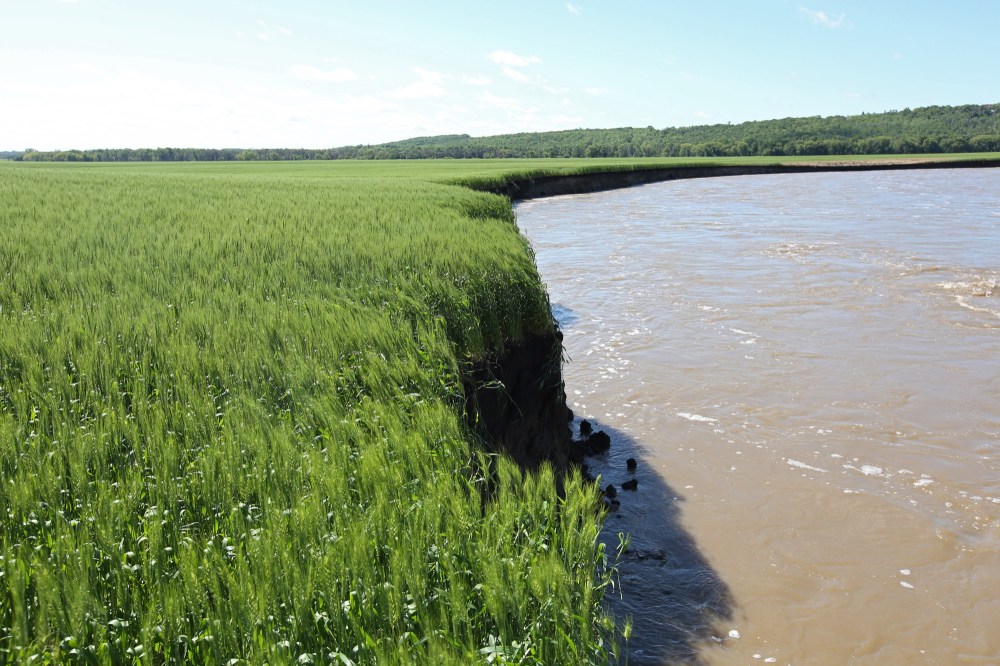
Even with an unhelpful storm rolling through the region early Wednesday morning, water levels continue to decline in Westman.
As measured at First Street on Wednesday at 7:39 a.m., the water in the Assiniboine River in Brandon was at 1,169.22 feet above sea level. That’s down almost a foot from the 1,169.97 feet above sea level measured around the same time on Tuesday.
At Lake Wahtopanah in Rivers, the water level continued to decline, even with the rainfall. As of 2 p.m., the surface of the water was at 469.588 metres above sea level, down from 469.713 feet above sea level the same time on Tuesday.
The normal water height for the lake at this time of year is 468.4 metres above sea level. The provincial government is waiting for the water level to recede further so the dam can be properly inspected and the possibility of the dam’s collapse can be ruled out.
For this reason, the City of Brandon’s clay dike plug along 18th Street North at Grand Valley Road remains in place and Queen Elizabeth Park and Dinsdale Park remain closed.
According to hydrometric data obtained from the federal government, the water flowing out of the spillway from the dam and then into the Little Saskatchewan River was approximately 3,884 cubic feet per second. That’s down from 4,400 cubic feet per second on Tuesday.
While not all roads have been reopened or repaired since the massive storm on June 28 and 29, the situation has improved.
As of 5:15 p.m. on Wednesday, here were the roads in Westman still closed due to flooding according to Manitoba 511.
• Highway 16A in Minnedosa is closed from one kilometre north of the Little Saskatchewan River to the northern junction with Highway 16.
• Highway 25 from Wheatland to Highway 10 has water on it and is open for local traffic only.
• Provincial Road 262 12 kilometres north of Clanwilliam is closed.
• Provincial Road 355 heading west from Minnedosa is closed due to washouts except for local traffic until the junction with Provincial Road 270.
ª Provincial Road 459, also known as Grand Valley Road, is closed except for local traffic from Highway 10 to the Trans-Canada Highway.
• Provincial Road 465 is closed due to flooding from three kilometres east of Cordova to Provincial Road 464.
• Provincial Road 471 from Rosedale to Bethany is closed due to washouts except for local traffic.
» cslark@brandonsun.com
» Twitter: @ColinSlark