Snowfall ‘encouraging’ for farmers: KAP
Advertisement
Read this article for free:
or
Already have an account? Log in here »
We need your support!
Local journalism needs your support!
As we navigate through unprecedented times, our journalists are working harder than ever to bring you the latest local updates to keep you safe and informed.
Now, more than ever, we need your support.
Starting at $15.99 plus taxes every four weeks you can access your Brandon Sun online and full access to all content as it appears on our website.
Subscribe Nowor call circulation directly at (204) 727-0527.
Your pledge helps to ensure we provide the news that matters most to your community!
To continue reading, please subscribe:
Add Brandon Sun access to your Free Press subscription for only an additional
$1 for the first 4 weeks*
*Your next subscription payment will increase by $1.00 and you will be charged $20.00 plus GST for four weeks. After four weeks, your payment will increase to $24.00 plus GST every four weeks.
Read unlimited articles for free today:
or
Already have an account? Log in here »
Hey there, time traveller!
This article was published 18/01/2022 (1523 days ago), so information in it may no longer be current.
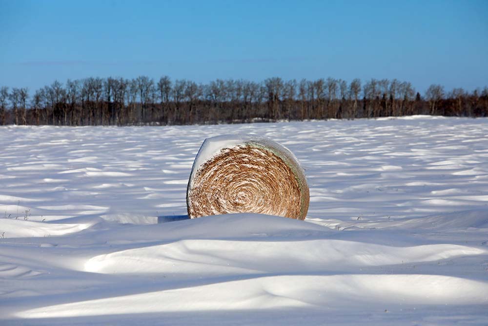
Westman farmers are cautiously optimistic toward positive growing conditions in the spring based on a small increase in precipitation seen this winter.
“What we are seeing happening this year with the snowfall is certainly encouraging,” said Bill Campbell, president of Keystone Agricultural Producers.
“We see snowbanks on the landscape, comparative to other areas that are still brown, we are in a more favourable condition. Is it about normal, I’d say that maybe it is. We still have a fair bit of winter to go yet, we’re not to the first of February yet and there’s always the potential for another Colorado low or Alberta clipper.”
Based on data from Environment Canada, Brandon has received 28.7 millimetres of precipitation thus far over the meteorological winter, which measures the precipitation between the months of December, January and February.
For December, the city received 16.8 mm, accounting for 80 per cent of the monthly average of 20.9 mm, while January has generated 11.9 mm, accounting for 67 per cent of the monthly average of 17.8 mm, roughly halfway through the month.
Compared to the meteorological winter of 2021, Brandon only received 24.7 mm of precipitation, well below the average of 52.2 mm. Last year would account for only 47 per cent of the long-term average, which caught the attention of meteorologists across the region.
“Last year was the seventh-driest winter on record out of 80 years,” said Terri Lang, meteorologist of environment and climate change for the Prairie region of Environment Canada.
Snowfall for Brandon is up from 40.4 centimetres over the 2021 meteorological winter to 69.8 cm over this year’s same time period not including February. Lang said the reason why Environment Canada strictly measures amounts in precipitation is because snowfall can be deceptive to account for.
“The moisture content that comes out of snow varies so much,” Lang said.
“You can get a foot of snow, but sometimes like the other week, you melt it down, and not a lot of precipitation comes out of it. Other times, when the precipitation falls when it’s mild, you can get a whole bunch of moisture that comes with it.”
The meteorologist explained as the snowpack changes over time, processes in the atmosphere allow for less snow to stay on the ground.
“As we go through time, some of it melts, some of it sublimates and loses moisture in the atmosphere without it melting.
“Sometimes it looks like, ‘Oh, my gosh, there is so much snow,’ but over time we lose some of that moisture.”
Further data from Environment Canada compiles statistics from the Canadian drought monitor, a map that measures the entire country in terms of five levels of drought intensity, ranging from abnormally dry to an exceptional drought. As of Dec. 31, 2021, the Westman region is currently placed in between a mix of moderate to severe drought.
The map highlights that southern Manitoba as a whole saw significant fall and early winter precipitation, thus removing a concern for short-term drought conditions. However, the numbers indicate the amount of precipitation received is less than required to make up for the deficits of last year’s dry winter.
“At this point, any moisture is needed just because the drought has been so long in the making, so it’s going to take a long time to make up for all of that precipitation,” Lang said.
A similar chart detailing the departure from average precipitation for southwestern Manitoba finds the region has lost between 120 to 400 mm of precipitation over the last two years.
“I think people like to see the snow and think it’s going to help with the drought, but you have to put it in the bigger context,” Lang said.
“Any snow we get is absolutely beneficial to help with drought, but it doesn’t come overnight.”
Going into spring, Campbell said over time, the wind greatly factors into determining how much snowfall will be left on the ground.
“I’ve been doing this for over 50 years, and I don’t know if there’s any ruler or gauge that can indicate we’ve got this much snow so we’ve got this much going into the subsoil for next year,” Campbell said.
“We can have snow, but will it stay on the land? We have utilized the practices of zero-till and minimum-till, but once that stubble is full of snow, at a certain point it doesn’t necessarily benefit the subsoil moisture or the land if the snow is blown away.”
Campbell said a couple more snowfall events and some timely rains in the spring with a favourable runoff period and enough snow staying on the ground would benefit the growing season.
“We’re in a better position than a lot of other areas. Will it completely fix everything? I don’t know,” he said.
“There is still a ways to go, we have a bunch of winter to get through yet.”
» jbernacki@brandonsun.com
» Twitter: @JosephBernacki