
On alert: City eyes water levels
Advertisement
Read this article for free:
or
Already have an account? Log in here »
We need your support!
Local journalism needs your support!
As we navigate through unprecedented times, our journalists are working harder than ever to bring you the latest local updates to keep you safe and informed.
Now, more than ever, we need your support.
Starting at $15.99 plus taxes every four weeks you can access your Brandon Sun online and full access to all content as it appears on our website.
Subscribe Nowor call circulation directly at (204) 727-0527.
Your pledge helps to ensure we provide the news that matters most to your community!
To continue reading, please subscribe:
Add Brandon Sun access to your Free Press subscription for only an additional
$1 for the first 4 weeks*
- Enjoy unlimited reading on brandonsun.com
- Read the Brandon Sun E-Edition, our digital replica newspaper
*Your next Free Press subscription payment will increase by $1.00 and you will be charged $20.95 plus GST for four weeks. After four weeks, your payment will increase to $24.95 plus GST every four weeks.
Read unlimited articles for free today:
or
Already have an account? Log in here »
Hey there, time traveller!
This article was published 13/05/2022 (1625 days ago), so information in it may no longer be current.
Areas west of Brandon were expected to receive the brunt of a heavy rainstorm making its way through the area Thursday night.
On Wednesday, Environment and Climate Change Canada issued a special weather statement for southern Manitoba and southeastern Saskatchewan predicting 30 to 50 millimetres of rain in some areas, with isolated pockets potentially receiving more than 60 millimetres.
Brandon and areas further east won’t be subjected to the worst of these conditions, but areas further west in Manitoba and especially southeastern Saskatchewan will, meteorologist Alysa Pederson said Thursday morning.
“There’s actually some thunderstorm activity already south of the border in North Dakota, so that’s where we’re expecting the storm to come from,” she said. “It’s developing in the States and moving northwards pretty rapidly by [Thursday] evening.”
Already this spring, Manitoba has seen a mix of weather events including blizzards, snowfall, and rain storms. Pederson said the ground is likely still saturated with water, and additional precipitation could lead to trees and power lines becoming unstable and potentially falling over.
On top of that rain, some areas could see massive wind gusts clocking in at around 90 kilometres per hour.
“We’re still in kind of a La Niña pattern,” Pederson said about the conditions causing these repeated storms. “What that means is Western Canada is generally cooler than normal under a trough and Eastern Canada is warmer than normal … Manitoba is kinda caught in the middle, so that’s why all of these storms seem to be triggering in the States, developing and then moving up into Manitoba.”
Late Wednesday afternoon, Manitoba’s Hydrologic Forecast Centre issued an overland flood warning for the southwest and southeast corners of the province and a less severe overland flood watch for the rest of the province because of the impending rain.
“An overland flood warning indicates a higher probability of overland flooding occurring based on forecast precipitation, whereas an overland flood watch indicates that overland flooding is possible but not as likely to occur,” the flood bulletin stated.
Due to previous precipitation, 28 communities in Manitoba have issued states of local emergency, though none of those are in Westman.
The City of Brandon’s emergency co-ordinator, Tobin Praznik, said municipal staff have remained on alert for potential overland flooding because of the frequent rain.
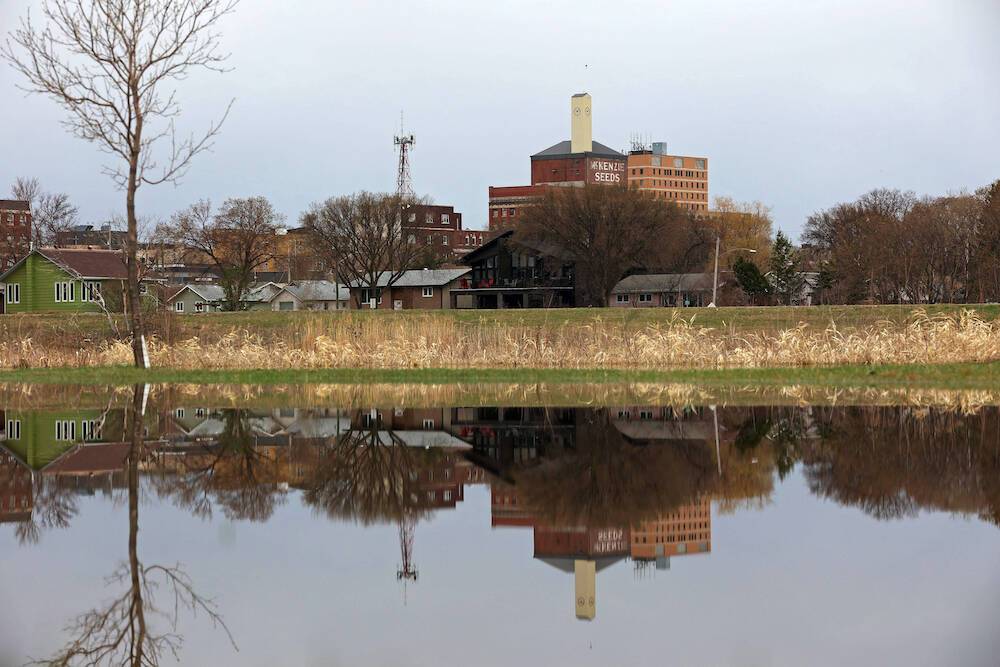
He said some low-lying areas around the Assiniboine River have already seen some flooding, which has led to the closure of the Red Willow Pedestrian Trail near the Riverbank Discovery Centre.
Because of rain falling on areas that feed into the Shellmouth Dam, which eventually flows into the Assiniboine, Praznik said there is the potential for the water level to rise.
Praznik isn’t yet sure if the city will be required to erect a temporary dike plug to block off Grand Valley Road like it did during the flood of 2020.
If overland flooding leads to any potential danger to residents, the city will send out alerts through its social media accounts. Should a resident see a drainage problem involving city infrastructure, Praznik asks that they call 204-729-2285.
He recommends that residents have a plan in place should they have to leave their homes, and to be careful of muddy, slippery conditions when near the river.
As of 2 p.m. Thursday, the water in the Assiniboine River measured at 358.4 metres above sea level. A month previous, the water was at 357.2 metres above sea level.
» cslark@brandonsun.com
» Twitter: @ColinSlark