More rain on the way for an already soggy Westman
Advertisement
Read this article for free:
or
Already have an account? Log in here »
We need your support!
Local journalism needs your support!
As we navigate through unprecedented times, our journalists are working harder than ever to bring you the latest local updates to keep you safe and informed.
Now, more than ever, we need your support.
Starting at $15.99 plus taxes every four weeks you can access your Brandon Sun online and full access to all content as it appears on our website.
Subscribe Nowor call circulation directly at (204) 727-0527.
Your pledge helps to ensure we provide the news that matters most to your community!
To continue reading, please subscribe:
Add Brandon Sun access to your Free Press subscription for only an additional
$1 for the first 4 weeks*
- Enjoy unlimited reading on brandonsun.com
- Read the Brandon Sun E-Edition, our digital replica newspaper
*Your next Free Press subscription payment will increase by $1.00 and you will be charged $20.95 plus GST for four weeks. After four weeks, your payment will increase to $24.95 plus GST every four weeks.
Read unlimited articles for free today:
or
Already have an account? Log in here »
Hey there, time traveller!
This article was published 14/06/2022 (1439 days ago), so information in it may no longer be current.
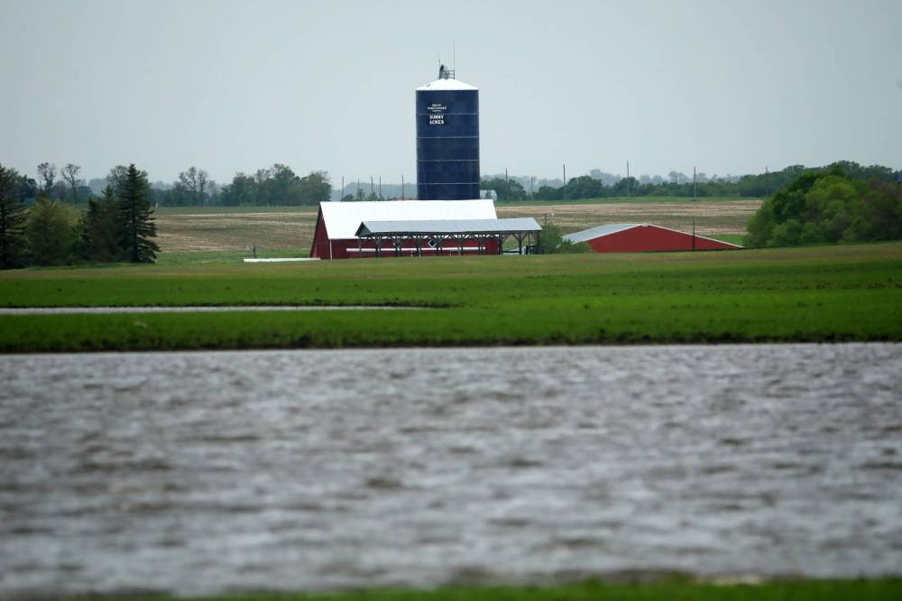
While the worst may be over, Brandon and area residents should prepare for another couple days of rain, according to Environment and Climate Change Canada.
Meteorologist Sara Hoffman told the Sun Tuesday afternoon that the massive thunderstorm that began Monday night had already resulted in around 38 to 55 millimetres of precipitation in the region. The system is expected to linger until at least Friday.
“It’ll be much more gentle showers than the thunderstorms that rolled through,” Hoffman said.
Five to 10 more millimetres of rain is anticipated today and up to five millimetres Thursday.
The massive rainfall over Monday and Tuesday has taken a toll on the Westman region, resulting in provincial flood warnings being issued for areas near Brandon, Glenora and the Rivers Reservoir as of Tuesday evening.
The Municipality of North Norfolk declared a state of emergency Tuesday morning after the rain prompted significant flooding within the town of Austin.
MacGregor, which is located 90 kilometres east of Brandon, was also heavily impacted by the storm, with several major roads in the region being closed due to the rain.
In terms of what is causing this severe weather, Hoffman said a large low-pressure system hovering over Alberta is the main culprit.
“So the thunderstorms that impacted most of southern Manitoba are actually associated with a cold front of that low-pressure system,” she said.
“That low-pressure system that’s over Alberta has yet to move eastward out of the area. Once it does, then conditions will begin to stabilize across the Prairies. But that won’t be until probably Friday, I’d say.”
Manitobans have had to endure an unusual amount of rain this year, with the province starting to emerge from the second-wettest spring on record.
This month has seen its fair share of precipitation — Brandon has received 18.3 millimetres of rain throughout June 6-12, according to the most recent provincial crop report.
While this has resulted in a cooler-than-average start to the summer, Hoffman said temperatures are expected to go back up on Friday, with the forecast calling for highs of around 25 C on Friday and 30 C on Saturday.
“That heat is going to feel kind of shocking,” she said. “So just to remind folks, staying hydrated is really important. [Use] sunscreen. Plan activities for not the peak of the day. And stay tuned to the alerts as they come out, because if it does reach heat warning criteria, we will issue heat alerts for that.”
» kdarbyson@brandonsun.com
» Twitter: @KyleDarbyson