Brandon gets its first snow of the season
Advertisement
Read this article for free:
or
Already have an account? Log in here »
We need your support!
Local journalism needs your support!
As we navigate through unprecedented times, our journalists are working harder than ever to bring you the latest local updates to keep you safe and informed.
Now, more than ever, we need your support.
Starting at $15.99 plus taxes every four weeks you can access your Brandon Sun online and full access to all content as it appears on our website.
Subscribe Nowor call circulation directly at (204) 727-0527.
Your pledge helps to ensure we provide the news that matters most to your community!
To continue reading, please subscribe:
Add Brandon Sun access to your Free Press subscription for only an additional
$1 for the first 4 weeks*
- Enjoy unlimited reading on brandonsun.com
- Read the Brandon Sun E-Edition, our digital replica newspaper
*Your next Free Press subscription payment will increase by $1.00 and you will be charged $20.95 plus GST for four weeks. After four weeks, your payment will increase to $24.95 plus GST every four weeks.
Read unlimited articles for free today:
or
Already have an account? Log in here »
Hey there, time traveller!
This article was published 18/11/2024 (566 days ago), so information in it may no longer be current.
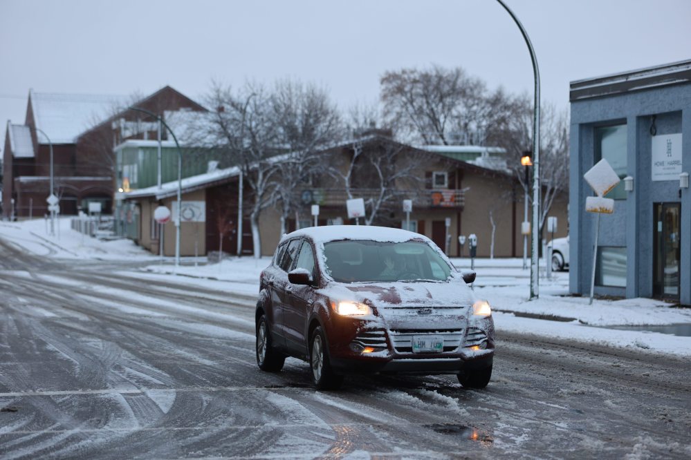
Brandon witnessed the first snowfall of the season on Saturday, an unusually late time of year for flakes to first fall for the city.
Environment Canada senior meteorologist Dan Fulton told the Sun that Wheat city’s weather patterns have been notably warmer for this time of year, which contributed to the delayed snowfall.
“The primary reason for the late snowfall is that Arctic air has not yet settled over the Prairies,” he said. “There is pretty cold air in the Arctic, but it just hasn’t come down over the prairies yet, and it’s probably related to climate change and all those things.”

Fulton said Western Manitoba residents, including Brandon, should expect a stark contrast to the current mild conditions.
“We are looking at a fairly significant storm that’s going to affect the region. For Tuesday, you can expect probably early morning hours some rain, or possibly some freezing rain, depending on the temperature. But that will probably change to snow on Tuesday, and then we’re looking at fairly significant snow,” he said.
He said residents should expect up to 20 centimetres to fall throughout the day Tuesday into Wednesday morning, “This is going to be a pretty big one and it’s going to be quite windy. We’re looking at northwest winds of around 50, gusting 70 kilometres per hour.”
As the storm progresses into Wednesday, he cautioned, conditions are expected to worsen, with high winds leading to blowing snow and low visibility: “Travel will be very difficult, so it’s advised that people avoid unnecessary travel on Tuesday and Wednesday.”
Fulton said temperatures will drop significantly on Thursday, bringing clearer skies but “much colder weather” with daytime highs expected to be around -8 C.”
The cold weather will persist as the region transitions into a period of Arctic air, marking the true arrival of winter, he added.
Fulton also stated that, based on historical trends, Brandon could experience temperatures as low as -30 C later this winter.
For residents, especially drivers, preparing for the severe conditions ahead is essential, he advised, and the city will need to be ready for snow removal and residents should expect difficult driving conditions.
» aodutola@brandonsun.com
» X: @AbiolaOdutola