Funnel cloud sightings reported near Brandon
Advertisement
Read this article for free:
or
Already have an account? Log in here »
We need your support!
Local journalism needs your support!
As we navigate through unprecedented times, our journalists are working harder than ever to bring you the latest local updates to keep you safe and informed.
Now, more than ever, we need your support.
Starting at $15.99 plus taxes every four weeks you can access your Brandon Sun online and full access to all content as it appears on our website.
Subscribe Nowor call circulation directly at (204) 727-0527.
Your pledge helps to ensure we provide the news that matters most to your community!
To continue reading, please subscribe:
Add Brandon Sun access to your Free Press subscription for only an additional
$1 for the first 4 weeks*
*Your next subscription payment will increase by $1.00 and you will be charged $20.00 plus GST for four weeks. After four weeks, your payment will increase to $24.00 plus GST every four weeks.
Read unlimited articles for free today:
or
Already have an account? Log in here »
Hey there, time traveller!
This article was published 11/07/2025 (295 days ago), so information in it may no longer be current.
Five funnel cloud sightings were reported near Brandon early Friday evening as a storm system peaked in the area.
A wave of reports came in to Environment and Climate Change Canada by 5 p.m., when scientist Christy Climenhaga told the Sun that the storm had reached its peak threat level. Reports came from several areas northeast of Brandon in the areas of Chater, Hallboro, Fairview and Brookdale, she said.
“We do have some decent cells rolling through the area right now,” she said at the time. “Once we see the evening roll on, we should start to see some relief.”
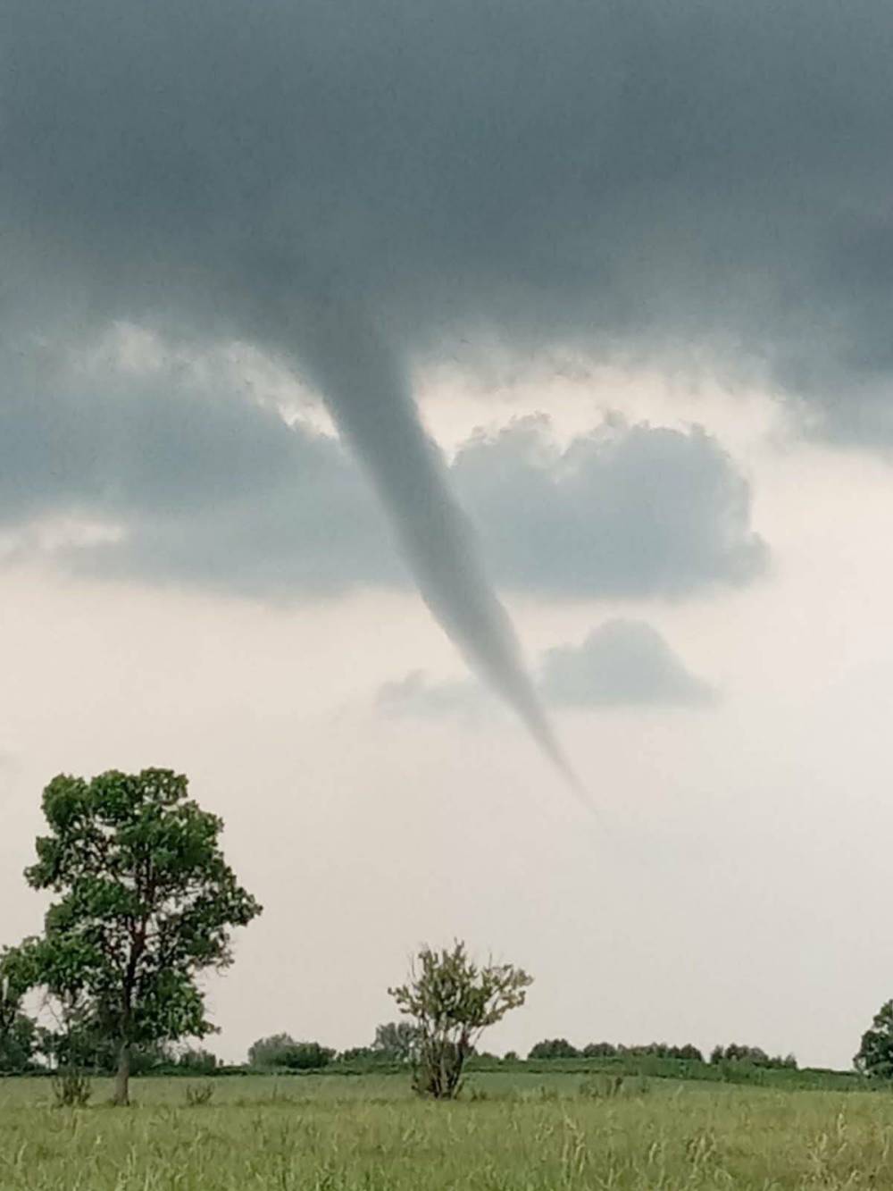
A funnel cloud spotted near Neepawa on Friday afternoon. (Diana Davidson and Alyx Delaloye/Facebook)
No reports had been received of any touchdowns at the time.
A special weather statement showed the area around Brandon at risk of funnel clouds. The box around Brandon included Virden, Souris, Boissevain, Neepawa, Carberry and Minnedosa.
The storm poses a risk if it touches down in a populated area. The wind speeds are commonly in the range of 100 kilometres per hour if they reach the ground, Climenhaga said.
“If they do touch down, they are technically a tornado, but they often are weaker in strength,” she said. “They often do just stay aloft, but there is that chance that they can touch down, so we do want to treat them with caution, because it is possible.”
Cold air high up in the atmosphere creates the conditions for the funnel to form, Climenhaga said. The clouds have the same appearance as a tornado, but often stay up in the sky or only touch down for a short time.
Summer is the most common season to see funnel cloud storms, she said.
» cmcdowell@brandonsun.com