
Westman taken by storm again
Advertisement
Read this article for free:
or
Already have an account? Log in here »
We need your support!
Local journalism needs your support!
As we navigate through unprecedented times, our journalists are working harder than ever to bring you the latest local updates to keep you safe and informed.
Now, more than ever, we need your support.
Starting at $15.99 plus taxes every four weeks you can access your Brandon Sun online and full access to all content as it appears on our website.
Subscribe Nowor call circulation directly at (204) 727-0527.
Your pledge helps to ensure we provide the news that matters most to your community!
To continue reading, please subscribe:
Add Brandon Sun access to your Free Press subscription for only an additional
$1 for the first 4 weeks*
- Enjoy unlimited reading on brandonsun.com
- Read the Brandon Sun E-Edition, our digital replica newspaper
*Your next Free Press subscription payment will increase by $1.00 and you will be charged $20.95 plus GST for four weeks. After four weeks, your payment will increase to $24.95 plus GST every four weeks.
Read unlimited articles for free today:
or
Already have an account? Log in here »
Communities across Westman are assessing widespread damage after another round of severe thunderstorms Sunday evening into Monday brought large hail, torrential rain, damaging winds and localized flooding.
Boissevain, Killarney, Wawanesa, Souris and surrounding areas were among the hardest hit, with reports of golf ball- to baseball-sized hail, flooded roads, damaged homes and vehicles, fallen trees, power outages and extensive damage to crops and gardens.
The weather compounded an already difficult week for the municipalities.
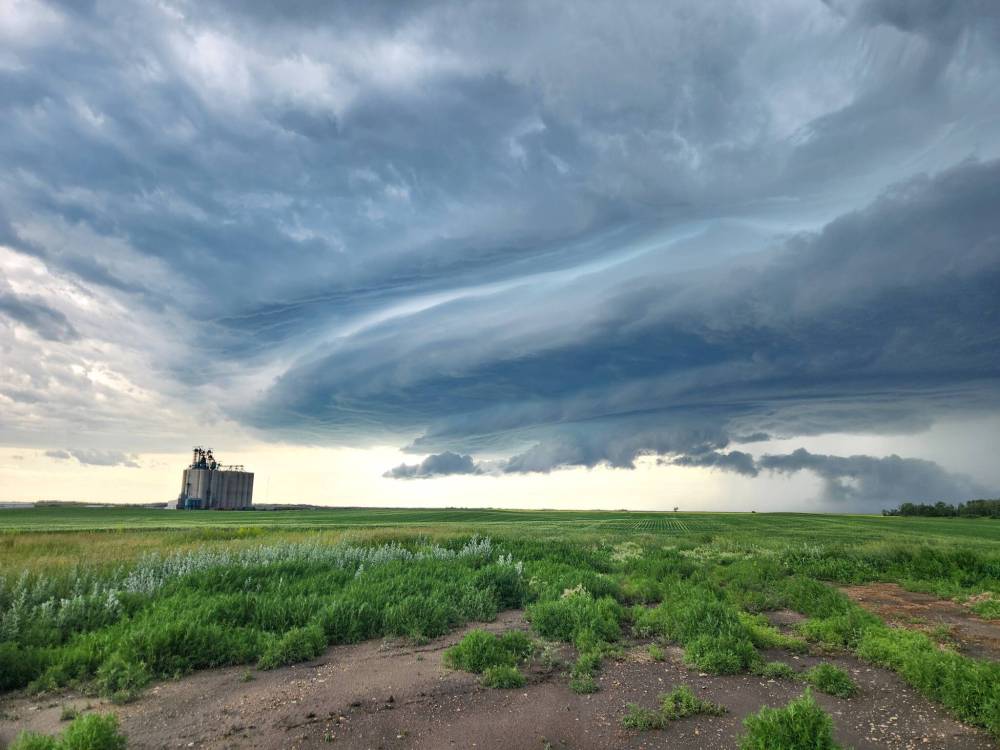
A massive storm system that brought strong wind, rain and large hail hovers over a Prairie grain terminal west of Boissevain on Sunday evening. (Jonah Dueck)
The Weather Centre of Manitoba founder Justin Oertel said the storms were among the most severe of the season.
“Environment Canada issued many severe thunderstorm warnings beginning around 4 p.m. Sunday and continuing into the overnight hours,” Oertel told the Sun on Monday. “In all of those communities, heavy rain and large hail occurred. The Town of Souris had already received over two inches (50mm) of rain by late yesterday evening, and it received more rain overnight.”
He said repeated thunderstorms moving over the same locations — known as “training thunderstorms” — intensified rainfall totals and increased the risk of flash flooding.
Boissevain has endured two major weather events within days.
Chief administrative officer Leo Poulin said the community was still recovering from flash flooding earlier in the week when another storm struck Sunday evening.
“It has been a rough week,” Poulin told the Sun. “We had flash flooding earlier in the week, then a power outage Sunday afternoon, and shortly after 4 p.m., we watched the sky darken before the hailstorm arrived.”
He said the hailstones were up to two inches in diameter, smashing windows, denting vehicles and damaging roofs and outdoor furniture.
“Every street was flooded,” he said in an interview on Monday. “It looked like a scene from ‘Jumanji’ with tree branches everywhere.”
Residents are now dealing with multiple insurance claims while municipal crews continue clearing debris and storm drains.
“It’s devastating,” Poulin said. “People hadn’t even recovered from the first event.”
Boissevain resident Jonah Neufeld said the hail damage affected his vehicle.
“My car has significant hail damage on the roof, hood and windshield,” Neufeld told the Sun. “I’ve made a claim with MPI, and I know many other folks from town have as well.”
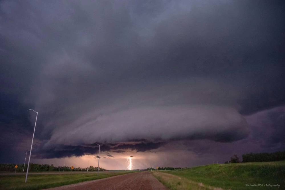
A storm system that brought strong winds and rain hovers west of Brandon, northwest of Kemnay along the Trans-Canada Highway at around 12:45 a.m. on Monday. (Photo by Justin Oertel)
While he had not heard of widespread structural damage to homes, Neufeld said trees throughout the community were stripped of foliage, leaving branches and leaves scattered across streets.
Neufeld said the storm came after an earlier power outage that complicated recovery from the previous week’s heavy rainfall.
“Last week we had a pretty significant rain event that caused a lot of basement flooding, and my sump pump is still running regularly,” he said. “I was able to borrow a generator from my dad to keep my basement dry. Hydro crews got everything up and running pretty quickly, thankfully. Hats off to them.”
Although he had not heard of any injuries, Neufeld said he worries about the impact on livestock and wildlife.
“I’ve never seen hail that big here,” he said. “I witnessed one deer running for shelter. I hope it found some.”
The Municipality of Oakland-Wawanesa spent Monday assessing widespread storm damage that included washed-out rural roads, flooded fields, hail damage, fallen trees and power outages.
Chief administrative officer Joni Swidnicki said eight roads were closed while several others remained under observation because of standing water.
Hydro poles along Highways 2 and 340 were snapped near ground level by powerful winds, leaving some residents without electricity.
The municipality was also considering declaring a local state of emergency to help secure additional crews and construction materials.
“Our two gravel pits are currently underwater,” Swidnicki said. “To repair the roads, we’ll likely need to bring in materials from elsewhere.”
Despite the destruction, she praised residents for quickly beginning cleanup efforts.

Boissevain resident Jonah Neufeld's vehicle has significant hail damage on the roof, hood and windshield. (Supplied)
“Everybody was pitching in and cleaning up their yards,” she said. “It’s really a matter now of getting things cleaned up and getting back to normal.”
Killarney-Turtle Mountain Mayor Janice Smith said Sunday’s storm was “utterly devastating.”
The storm rapidly intensified from rain into a violent hailstorm, producing hailstones ranging from pea-sized to as large as pickleballs.
“Everything has been affected,” Smith said in an interview. “Trees, gardens, vehicles, roofs, windows, siding, basements — everybody has been impacted in one way or another.”
Municipal crews immediately began clearing clogged drains, repeatedly removing leaves stripped from trees to prevent streets from flooding further, she said.
“There isn’t a flower left along Broadway,” Smith said. “The ground looks worse than it does in the fall. It’s like a war zone.”
While property damage was extensive, Smith said there were no reports of serious injuries.
The Rural Municipality of Ellice-Archie has officially declared a state of local emergency due to rising water levels in the rivers near thearea, about 120 kilometres northwest of Brandon, near the Manitoba-Saskatchewan border.
This declaration will remain in effect until Aug. 4 unless otherwise extended or rescinded, the municipality said in a statement posted on social media.
“Rising water levels continue to pose risks to public safety, infrastructure, and property,” it read. “The RM is actively monitoring the situation and taking necessary measures to respond to changing conditions. We ask all residents to stay informed, exercise caution, and follow any advisories or instructions issued by local officials. Further updates will be provided as information becomes available.”
Although Brandon escaped major damage, Oertel said conditions briefly became favourable for a tornado west of the city.
Radar detected a strong rotational signature between Oak Lake and western Brandon for about an hour overnight.
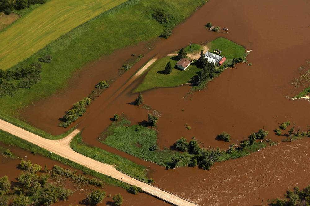
A home and farm sit on an island of dry land, surrounded by the floodwaters of the swollen Assiniboine River just west of Russell in early July. Russell is included in an overland flood watch issued by the province on Friday. (Tim Smith/The Brandon Sun)
“Thankfully, no tornado was observed or reported,” he said. “But Brandon was very fortunate. It shows why everyone needs to be prepared because tornadoes absolutely can strike urban centres.”
The communities are not out of the woods.
Environment and Climate Change Canada meteorologist Terri Lang said southwestern Manitoba remains in a weather pattern.
“We’re not getting much of a reprieve,” Lang said. “There are a couple of quieter days, but another round of showers and thunderstorms is possible Thursday, and some storms could become severe.”
She said residents should remain weather-aware throughout Manitoba’s peak severe weather season.
“Have a way to receive warnings, have a plan, and when severe weather threatens, implement that plan immediately,” Lang told the Sun.
» aodutola@brandonsun.com
» X: @AbiolaOdutola