
Various burn bans, travel restrictions in place
Advertisement
Read this article for free:
or
Already have an account? Log in here »
We need your support!
Local journalism needs your support!
As we navigate through unprecedented times, our journalists are working harder than ever to bring you the latest local updates to keep you safe and informed.
Now, more than ever, we need your support.
Starting at $15.99 plus taxes every four weeks you can access your Brandon Sun online and full access to all content as it appears on our website.
Subscribe Nowor call circulation directly at (204) 727-0527.
Your pledge helps to ensure we provide the news that matters most to your community!
To continue reading, please subscribe:
Add Brandon Sun access to your Free Press subscription for only an additional
$1 for the first 4 weeks*
- Enjoy unlimited reading on brandonsun.com
- Read the Brandon Sun E-Edition, our digital replica newspaper
*Your next Free Press subscription payment will increase by $1.00 and you will be charged $20.95 plus GST for four weeks. After four weeks, your payment will increase to $24.95 plus GST every four weeks.
Read unlimited articles for free today:
or
Already have an account? Log in here »
Hey there, time traveller!
This article was published 06/04/2021 (1987 days ago), so information in it may no longer be current.
High wildfire danger levels have resulted in swaths of burn bans and travel restrictions to be put in place throughout the province.
Manitoba Wildfire Services announced Level 2 travel restrictions in the southern half of the province, including much of the southeast.
Similar restrictions are in place for various provincial parks, including Turtle Mountain, Spruce Woods, William Lake and Criddle/Vane Homestead, Whitemouth Falls, Marchand, Woodridge, Whiteshell, Moose Lake and Birch Point. Also affected is the Spruce Woods provincial forest and surrounding Crown Land.
Level 2 travel restrictions include:
• Motorized backcountry travel, including ATVs and other off-road vehicles, is prohibited unless under the authority of a travel permit
• Camping is restricted to developed campgrounds
• Campfires are permitted only between the hours of 8 p.m. and 8 a.m.
• Wayside parks remain open
• Landing and launching is restricted to developed shorelines only
• Industry and outfitters should contact local Manitoba Conservation and Climate offices for more information
Further, provincial burn permits within these areas will be limited to essential agricultural, municipal or industrial operations and will require the approval of an officer alongside site inspections.
Parts of Westman are some of the most at-risk for fires, according to Natural Resources Canada’s online fire danger map.
A circular area surrounding Brandon extending from about 15 kilometres south of the city up to Rapid City and from the Trans-Canada Highway’s junction with PR 250 in the west to the highway’s junction with PR 340 in the east is considered to be at moderate fire risk. However, Brandon itself is not included.
Another area stretching from Turtle Mountain Provincial Park northeast to Treherne is also at moderate risk. A third area stretching from just north of Russell to the southern tip of Duck Mountain Provincial Park is considered to be at low fire risk.
Most at-risk in Manitoba is the Winkler-Morden area, which is considered to be at high fire risk.
Manitoba Conservation and Climate’s fire hazard maps show that much of Westman is at moderate or high risk of human-caused fires. The difficulty of mopping up any wildfires in Manitoba’s further southwest corner is considered to be extreme.
According to the fire update report issued by the province on April 3, there have been three fires reported so far this year. There were two fires in the east zone that burned an area equivalent to 205 hectares and one fire in the west zone that burned an area equivalent to 226 hectares.
As of Monday afternoon, at least 14 Westman municipalities had imposed burn bans of their own, the majority of which are total bans. The province will not contradict these bans.
The communities with full or partial burn bans in Westman are as follows:
• Municipality of Two Borders (all burning banned)
• Municipality of Brenda-Waskada (all burning banned)
• Municipality of Deloraine-Winchester (burning with municipal permit only)
• Municipality of Boissevain-Morton (all burning banned)
• Municipality of Grassland (all burning banned)
• Rural Municipality of Pipestone (agricultural burning banned)
• Rural Municipality of Prairie Lakes (all burning banned)
• Municipality of Glenboro-South Cypress (all burning banned)
• Rural Municipality of Cornwallis (all burning banned)
• Municipality of North Cypress-Langford (all burning banned)
• Town of Carberry (all burning banned)
• Town of Neepawa (all burning banned)
• Municipality of Glenella-Lansdowne (No outdoor burning allowed)
• Municipality of Westlake-Gladstone (all burning banned)
Additionally, three RMs in the southwest corner of Saskatchewan also had burn bans in place, according to a map posted online by the Saskatchewan Public Safety Agency on Monday.
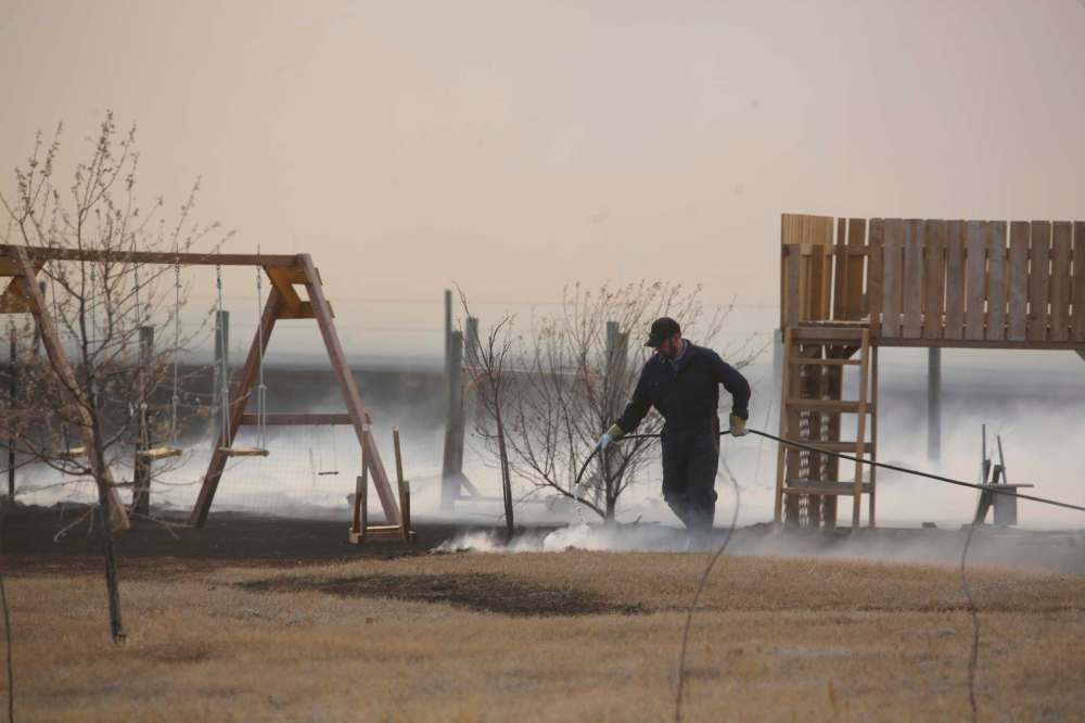
The plethora of bans comes on the heels of Thursday’s large grassfire in the Municipality of North Cypress-Langford, which has had a burn ban in place since March 19.
The fire, in the Dane subdivision in the Camp Hughes area several kilometres west of Carberry, came within striking distance of multiple homes, though a shed was damaged in the blaze.
The Carberry North Cypress-Langford Fire Department believes the fire originated from an ATV.
Westman ATV Association president Chad Finlay said his club doesn’t recommend heading out on ATVs at the moment, even in areas where they are allowed, but those who do should take precautions.
“Right now, we’re just advising to check with your local RM on travel bans, fire bans, and to travel with a fire extinguisher on your bike,” he said.
Riders should keep their exhaust free of debris, stick to trails and not park their machines on long grass.
The province offers similar advice, in addition to ensuring your ATV has a working spark arrestor and to carry an axe and shovel.
The latest restrictions are posted online at gov.mb.ca/wildfire.
» tclarke@brandonsun.com and cslark@brandonsun.com
» Twitter: @TylerClarkeMB and @ColinSlark