Quebec and Ontario officials are remaining on alert over spring flooding
Advertisement
Read this article for free:
or
Already have an account? Log in here »
We need your support!
Local journalism needs your support!
As we navigate through unprecedented times, our journalists are working harder than ever to bring you the latest local updates to keep you safe and informed.
Now, more than ever, we need your support.
Starting at $15.99 plus taxes every four weeks you can access your Brandon Sun online and full access to all content as it appears on our website.
Subscribe Nowor call circulation directly at (204) 727-0527.
Your pledge helps to ensure we provide the news that matters most to your community!
To continue reading, please subscribe:
Add Brandon Sun access to your Free Press subscription for only an additional
$1 for the first 4 weeks*
- Enjoy unlimited reading on brandonsun.com
- Read the Brandon Sun E-Edition, our digital replica newspaper
*Your next Free Press subscription payment will increase by $1.00 and you will be charged $20.95 plus GST for four weeks. After four weeks, your payment will increase to $24.95 plus GST every four weeks.
Read unlimited articles for free today:
or
Already have an account? Log in here »
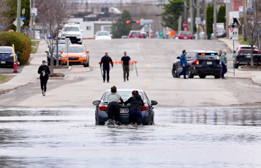
Communities along the Ottawa River were on high alert as water levels rose, amid spring floods at the start of a new week.
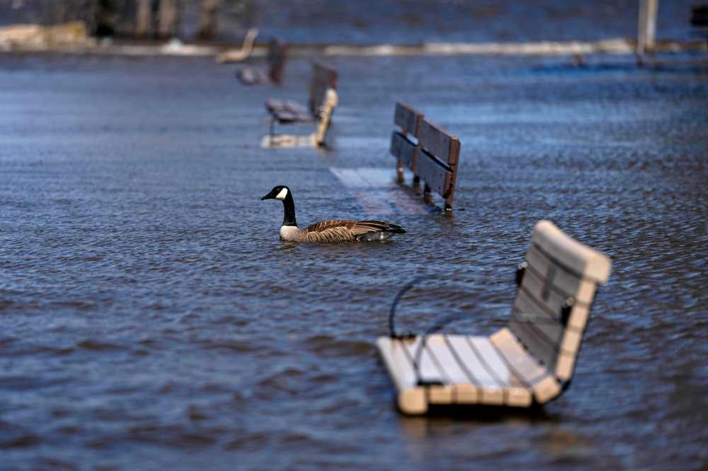
In Quebec, Ontario and New Brunswick, officials said they were monitoring rivers closely, with some areas already reporting minor to major flooding, states of emergency and preventive measures such as evacuations.
The most affected areas in Quebec are the Outaouais, Laurentians, Lanaudière and Quebec City regions, as well as a few municipalities in the Montérégie region south and east of Montreal, said Vincent Duquette, civil safety adviser for Quebec’s Public Safety Department.
Provincial data indicated one case of major flooding in Quebec, in the municipality of Fort-Coulonge in the province’s west. The city council declared a state of emergency on Sunday evening, and sandbag barriers were erected to prevent the Ottawa River from overflowing.
“For now, the rise seems to have slowed,” Mayor Pierre Cyr said in an interview on Monday. “The water level isn’t dropping, but the river appears stable.”
Scientists say that these types of emergencies are becoming more frequent and costly across the country, due to the consumption of fossil fuels and other human activity that contributes to global warming. The Canadian Climate Institute says climate change is driving increasingly severe and frequent floods in many parts of Canada.
On Sunday, Quebec Premier Christine Fréchette noted during a news conference in St-Eustache, in the Montreal area, that flooding is becoming increasingly common in the province because of climate change.
Quebec officials have reported a few dozen moderate and minor floods, and they are continuing to monitor more than a dozen waterways.
Authorities from the municipality of Mansfield-et-Pontefract, near Fort-Coulonge, said the situation was critical, as 70 homes and cottages have received an evacuation order, and about 30 others are also expected to be notified. The municipality’s general director, Éric Rochon, said residents weren’t all collaborative: ”Some want (to evacuate), some don’t.”
In Gatineau, at the peak, the river is forecast to be roughly 30 centimetres higher compared with late last week, Gatineau Mayor Maude Marquis-Bissonnette said in an interview Monday. Emergency teams have been deployed to monitor conditions and support residents, the mayor said, adding that 170 homes are at risk of flooding and 44 streets have been closed.
She compared the situation to major spring flooding that struck the region in 2023.
Montreal Mayor Soraya Martinez Ferrada told reporters on Monday that water levels were ‘high compared to previous years.’
“That’s why we’re monitoring this closely, but at the same time, we’re better prepared than in previous years,” she said, adding that the city had been preparing since mid-March and that, having learned from past experiences, it was able to take preventive action.
In Quebec City, a storm surge warning is in effect, with higher-than-normal water levels expected along the St. Lawrence River at high tide.
Meanwhile, a flood map from the Ontario government showed that northern and central parts of the province remained under flood warnings as of Monday. In Minden Hills, officials said Sunday that the town was under a state of emergency and more than 25,000 sandbags had been filled and picked up in the community.
Jill Dunlop, Ontario’s minister of emergency preparedness and response, said the government was helping to co-ordinate assistance with local authorities.
“Groups like Global Medic have been there with the sandbagging machine, the search and rescue have been there doing wellness checks, they set up an evacuation centre,” she said Monday morning. “We’ll continue to assess the situation and deploy whatever resources those communities need to support them.”
In West Nipissing, which was also under a state of emergency Monday, officials said crews were patrolling flooded areas, and several roads were closed. Elsewhere, officials in Mindemoya, said a water advisory remained in place as flooding risked compromising the town’s community water system.
Officials in New Brunswick’s capital, Fredericton, closed several trails Monday as Saint John River levels rose faster than forecast, the city said in a statement. The province was forecasting flooding in both Fredericton and nearby Gagetown on Tuesday.
Environment and Climate Change Canada said recent flooding has been driven by a combination of rainfall and rapid snowmelt.
But the federal department said cooler temperatures in Quebec and limited rainfall in the coming days were expected to ease pressure on river systems.
”The good news is that we don’t have a major system on the way,” said Environment Canada meteorologist Guillaume Perron, speaking on rainfall forecasts for Quebec and Ontario.
This report by The Canadian Press was first published April 20, 2026.
—with files from Pierre Saint-Arnaud in Montreal, Eli Ridder in Fredericton and Rianna Lim in Toronto