Spruce Woods trails show off unique area
Advertisement
Read this article for free:
or
Already have an account? Log in here »
We need your support!
Local journalism needs your support!
As we navigate through unprecedented times, our journalists are working harder than ever to bring you the latest local updates to keep you safe and informed.
Now, more than ever, we need your support.
Starting at $15.99 plus taxes every four weeks you can access your Brandon Sun online and full access to all content as it appears on our website.
Subscribe Nowor call circulation directly at (204) 727-0527.
Your pledge helps to ensure we provide the news that matters most to your community!
To continue reading, please subscribe:
Add Brandon Sun access to your Free Press subscription for only an additional
$1 for the first 4 weeks*
*Your next subscription payment will increase by $1.00 and you will be charged $20.00 plus GST for four weeks. After four weeks, your payment will increase to $24.00 plus GST every four weeks.
Read unlimited articles for free today:
or
Already have an account? Log in here »
Hey there, time traveller!
This article was published 18/04/2013 (4731 days ago), so information in it may no longer be current.
If you’ve ever been through Spruce Woods Provincial Park you may have been on a few of the trails, or have seen the signs along Highway 5. I am talking about the Epinette, Yellow Quill, Seton and the Spirit Sands Trail Systems just to name a few. You may be like me when I first arrived at the park and wondered what these trails are named for. Who or what is Seton? Since when is a quill yellow? I figure Fort Epinette must have to do with the fur trade, right? And why are the sands spiritual? One of the many things I love about this park is its rich and unique history to anywhere else in Manitoba. By learning how trails have been given their names, we can gain an appreciation for the history and culture of the park and discover Spruce Woods in the same way that the early fur traders, naturalists and first peoples have.
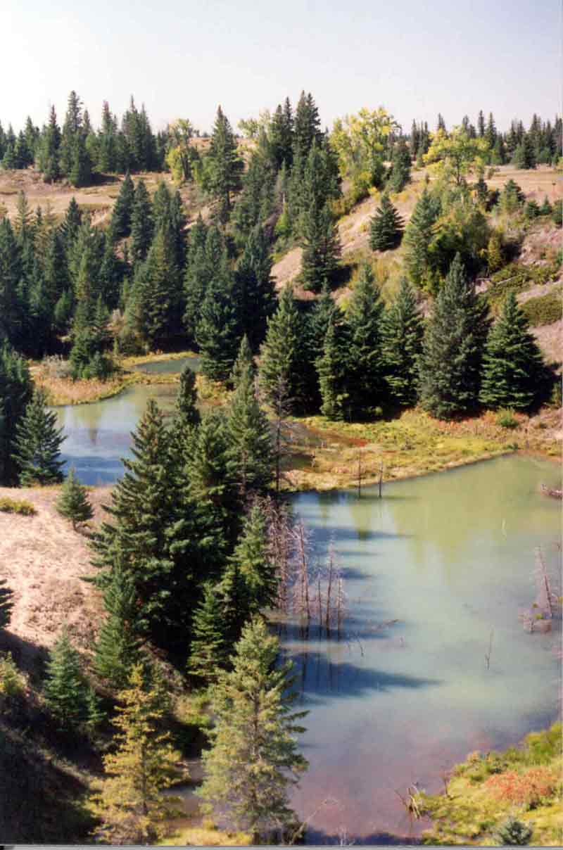
If you were travelling south on PTH 5 from the Trans Canada Highway, the first sign you would come across would be the Epinette Creek Trail System. In the years 1768-1781 the fur trade was booming and three independent Montreal fur traders named Corry, Oakes and Boyer maintained a supply post near the joining of Epinette Creek and the Assiniboine River. This fort was called Fort des Épinettes or Pine Fort. This trading post was re-established in 1785-1794 and again in 1807-1811 by the Montreal -based North West Company. Pine Fort may ring a bell if you have ever visited Kiche Manitou Day-use Area as we have our very own version of the fort, Pine Fort IV, where one can now purchase confectionary delights and rent canoes for the day. A bit different than the original version of furs, pemmican and wattap (spruce resin used to repair canoes) that were traded at the original forts. The Epinette Trail System in Spruce Woods has a varying length of routes for hiking, bicycling and cross-country skiing with overnight backcountry camping areas. These routes are named after local conifers Spruce (3.5 km), Juniper (2.2 km) and Tamarack (10.5 km).
Cross-country skiing on Spruce Trail, Epinette System
The Newfoundland Route is also a part of the Epinette System this trail was named after the province of Newfoundland and Labrador. In the 1970s, the Premier of Newfoundland at the time was visiting the park, and a ravine found along this route resembeled a ravine from his home town, hence the trail was named to recognize his visit and the cooperation between the two provinces in developing park lands in the 1970s. If you travel the Newfoundland Route, which includes the other three trails, you can travel a total of 41.7 km. An overnight stay at the Jackfish Cabin is a must in the winter season you can reserve the cabin by calling the Conservation and Water Stewardship Office in Carberry at 204-834-8800.
Quiet Voices Self-guiding Trail can also be found at the Epinette Trails staging area. The mixed-grass prairie found in the sand hills was formed over thousands of years, and was shaped by natural forces. The story goes that these forces will be the voices that tell you the story of the prairie. Wind, fire, sun, water, plants and animals each tell of their role in the cycle of life on the prairie. You are encouraged to stop, look and listen carefully at each site on the trail, to hear the message of each quiet voice.
Prairie crocus found along Quiet Voices trail
Continuing south you will next see the Seton Trail named after Ernest Thompson Seton. Seton was a well renowned naturalist, artist and father of the Woodcraft League and in turn the Boy Scouts. He lived in Carberry in the years 1882-1886 at his brother Arthur’s homestead He considered his time in Manitoba as his “Golden Years” and was appointed Manitoba’s first Chief Naturalist during this period. He would travel the countryside and explore the desert-like sands within modern day Spruce Woods Provincial Park sketching wildlife. 1,000 animal drawings were prepared for the Century Dictionary during this time. Seton also provided the illustrations for Frank M. Chapman’s Handbook of Birds, which were favorably compared with those of Audubon.
His legacy can be further discovered at the Seton Centre located in Carberry, Manitoba. The Seton Trail System in Spruce Woods has four routes which are considered quite difficult due to steep inclines and sand hills. Hike, bike, ski or snowshoe on these routes which are named after some of Seton’s artworks and stories Snowy Owl (2.9 km), Chaska (4 km), Sleeping Wolf (4.8 km) and Sandhill Stag (4.5 km).
Next along our journey would be the Yellow Quill Trail System. Previously unaware of the history of this name, I simply thought of yellow quills. I hadn’t a clue as to why the quills were yellow, but I found out the true meaning was actually the name of a well renowned first nations chief. Yellow Quill was a chief of a band of Saulteaux peoples in the late 1800’s. He was well known for signing treaty No. 4 on August 24, 1876. He is also known for presiding over two first nations, Long Plains No.6 and Swan Lake No. 7. The fur trade route between Portage la Prairie and Brandon on the Assiniboine River was a popular route from 1790-1886, and became known as the Yellow Quill Route. The Yellow Quill Trail System in Spruce Woods is also named after Chief Yellow Quill, where you can hike, ride your bicycle, snowshoe or cross-country ski on routes named after local first peoples Ojibwa Trail (1.8km), Cree Trail (5.1 km) and Assiniboine Trail (5.8 km).
Snowshoeing on Cree Trail, Yellow Quill System
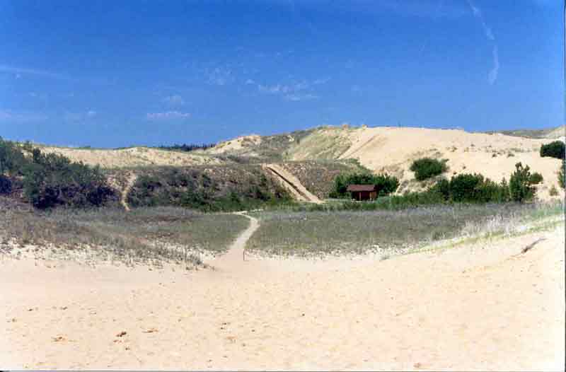
My personal favourite, the Spirit Sands and Devils Punch Bowl Self-guiding Trails, brings back memories of when I was a child and came out to the Park for the first time. We took a wagon ride through this amazing desert-like expanse of rolling hills and yellow sands. To this day I still find this a fascinating place to be and the most unique spot in Manitoba. Only here in Spruce Woods can you find wide open sand dunes and an eerie spring-fed pond in the sand, affectionately called the Devil’s Punch Bowl. You can look for endangered species such as the western hog-nosed snake slithering through the sands and the northern prairie skink Manitoba’s only lizard. You can also find rare plants such as the pincushion cactus. This place was just as amazing and fascinating to the first peoples who lived and visited in the area. So much so that it became a sacred place, a place close to the Great Spirit, Kiche Manitou. The name Spirit Sands pays respect to the sacred significance of this location. Here you can find hiking trails that will take you in and around the sand dunes, native mixed-grass prairie and spring-fed ponds. Visitors can make their own distance to suit their liking, from 2 km routes to 10 km routes. Try snowshoeing in the winter to explore the Spirit Sands in a whole different perspective.
Devils Punch Bowl and the Spirit Sands
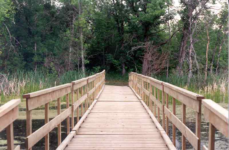
Closer to the Kiche Manitou Day Use Area another bevy of trails can be found. The Isputinaw Self-guiding Trail, meaning “high hill” in Ojibway, is a 1.4 km trail following the edge of the old Assiniboine River. Along this trail you can find the various species of plants that inhabit the varying soils along this slope. Spring Ridge Self-guiding Trail is named after the multiple springs found along the trail. With steep ups and downs but a shorter length at 1.2 km this trail is a refreshing jaunt with beautiful scenery. Marshs Lake Self-guiding Trail at 1.5 km, located off of PTH 5, is another personal favourite with an abundance of wildlife found along the easy flat trail. This trail and the equestrian/snowmobile trails are all named after families who homesteaded in the park.
Boardwalk on the Marshs Lake Trail
As you can see by learning how trails have been given their names, we can gain an appreciation for the history and culture of the park and discover Spruce Woods in the same way that the early fur traders, naturalists and first peoples have. As the Seton and Yellow Quill trails have recently been designated for year round use, you now have the opportunity to travel all of the Spruce Woods trails throughout the summer for the first time. Bring yourself, the family or the dog out for a hike, bike, ski, or snowshoe!
For more information on trails in Spruce Woods Provincial Park, please visit us online at ManitobaParks.com, drop by the Park Centre, contact me at 204-827-8850, or connect by email Jennifer.Bryson@gov.mb.ca
» Jennifer Bryson, Senior Park Interpreter